1
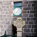
Mercat Cross, Stonehaven
The cross is circa 1645 and it was remodelled in 1887. The barometer is dated 1852.
Image: © Maigheach-gheal
Taken: 6 Oct 2009
0.01 miles
2
Public Barometer on the Town House of Old Stonehaven
Image: © Nick Mutton 01329 000000
Taken: 17 Aug 2008
0.01 miles
3
Old Town House from King Street
Built in 1790.
Image: © kim traynor
Taken: 3 Sep 2013
0.02 miles
4
Stonehaven mercat cross
Erected c.1645 and remodelled in 1887. The starting point and endpoint of the town's famous Hogmanay fireball procession.
Image: © kim traynor
Taken: 3 Sep 2013
0.02 miles
5
A view of Stonehaven Tolbooth tower
Glimpsed from an alley between the Old Pier and Stonehaven Bay.
Image: © Stanley Howe
Taken: 2 Apr 2014
0.02 miles
6
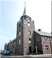
Clock Tower
The Clock Tower, townhouse, barometer and old Mercat Cross all in one location off the High Street In Stonehaven.
Image: © Andrew Wood
Taken: 26 Sep 2015
0.02 miles
7
Old townhouse, Stonehaven
Dating from 1790 on a constricted corner site and B-listed: http://portal.historicenvironment.scot/designation/LB41615 . Now a museum.
Image: © Bill Harrison
Taken: 27 May 2017
0.02 miles
8
Mercat cross, Stonehaven
Thought to date from the mid-17th Century, but heavily restored and a new head added in 1887 (Queen Victoria's golden jubilee). The head shows the Burgh arms (per fess: in chief paly of six or and gules, in base azure), which are inspired by those of the Keith family (argent, a chief gules three pallets or), but to differentiate it, the (horizontal) fess line is unusually low, as well as the change of tincture (colours): the azure (blue) base for the Stonehaven arms pays homage to its status as a fishing port. The motto "veritas vincit" (truth will prevail) is shared by the Burgh and the family. Behind, on the wall of the Townhouse, the barometer served a vital weather-forecasting function for fishermen.
Image: © Bill Harrison
Taken: 27 May 2017
0.02 miles
9
Stonehaven: looking down on the old town
The steeple belongs to the B-listed (LB41615 http://portal.historicenvironment.scot/designation/LB41615 ) Town House of 1790.
Image: © Bill Harrison
Taken: 14 Aug 2022
0.02 miles
10
The Town House of Old Stonehaven and Mercat Cross
House built in 1790, Cross in c. 1645. The public barometer which was installed in 1852 was of great benefit to the fishing community.
Image: © Nick Mutton 01329 000000
Taken: 17 Aug 2008
0.02 miles


