The Town House of Old Stonehaven and Mercat Cross
Introduction
The photograph on this page of The Town House of Old Stonehaven and Mercat Cross by Nick Mutton 01329 000000 as part of the Geograph project.
The Geograph project started in 2005 with the aim of publishing, organising and preserving representative images for every square kilometre of Great Britain, Ireland and the Isle of Man.

There are currently over 7.5m images from over 14,400 individuals and you can help contribute to the project by visiting https://www.geograph.org.uk
The Town House of Old Stonehaven and Mercat Cross
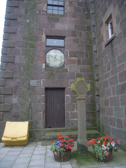
Image: © Nick Mutton 01329 000000 Taken: 17 Aug 2008
House built in 1790, Cross in c. 1645. The public barometer which was installed in 1852 was of great benefit to the fishing community.
Images are licensed for reuse under creativecommons.org/licenses/by-sa/2.0
Image Location
Latitude
56.960749
Longitude
-2.204459