
IMAGES TAKEN NEAR TO
LAURENCEKIRK, AB30 1FY
Introduction
This page details the photographs taken nearby to AB30 1FY by members of the Geograph project.
The Geograph project started in 2005 with the aim of publishing, organising and preserving representative images for every square kilometre of Great Britain, Ireland and the Isle of Man.

There are currently over 7.5m images from over14,400 individuals and you can help contribute to the project by visiting https://www.geograph.org.uk
Image Map
Images are licensed for reuse under creativecommons.org/licenses/by-sa/2.0
Notes
- Clicking on the map will re-center to the selected point.
- The higher the marker number, the further away the image location is from the centre of the postcode.
Image Listing (66 Images Found)
Images are licensed for reuse under creativecommons.org/licenses/by-sa/2.0
Image
Details
Distance
1

Site of the Boar’s Head Inn where Robert Burns stayed in Laurencekirk
The photo shows Kirkburn Court, the present-day housing development of flats at the junction of the High Street and Kirkburn in Laurencekirk that was previously in the county of Kincardineshire but is now in Aberdeenshire. The site of the modern block of flats has historic associations, for it was here that the Gardenstone Arms Hotel once stood, which at the time of Burns’ visit was known as the Boar’s Head Inn. Prior to the overnight stay by Robert Burns and Willi Nicol in 1787, Dr. Samuel Johnson and his travelling companion James Boswell had also stayed there on their celebrated tour of 1773 through the Scottish Highlands and Hebrides, some 14 years earlier. In more recent times the old coaching inn became somewhat derelict and was then destroyed by fire, with the site then being redeveloped for flats. In 1972 a brown-coloured plaque with gold lettering was installed in a central position in the front of the new development. The plaque reads:
GARDENSTONE ARMS HOTEL
Here originally the Boar’s Head
Inn ROBERT BURNS stayed
During his only visit to the land
Of his Fathers in Sept 1787.
Also meeting place of Glenbervie
Burns Memorials Association
Which erected this plaque -1972
Image: © Adrian Diack
Taken: 17 Jul 2025
0.01 miles
2
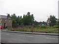
Hole in the road, Laurencekirk
A development site off Kirkhill.
Image: © Richard Webb
Taken: 2 Aug 2011
0.01 miles
3
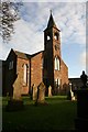
Laurencekirk kirk
Laurencekirk Parish Church with its spire.
Image: © Andrew Wood
Taken: 22 Dec 2008
0.04 miles
4
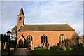
Laurencekirk Parish Church
The Church of Scotland parish church in Laurencekirk.
Image: © Andrew Wood
Taken: 22 Dec 2008
0.04 miles
5
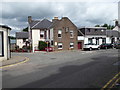
Royal Hotel, Laurencekirk
At junction of A937 and Station Road.
Image: © Stanley Howe
Taken: 12 Jul 2017
0.04 miles
6
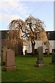
Laurencekirk churchyard.
The well-kept churchyard, with tree, of the parish kirk at Laurencekirk.
Image: © Andrew Wood
Taken: 22 Dec 2008
0.04 miles
7
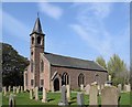
Laurencekirk parish kirk
Dating from 1804 with early Gothic revival tracery and B-listed (LB37229): http://portal.historicenvironment.scot/designation/LB37229 . Compare Echt parish kirk from the same year: https://www.geograph.org.uk/photo/4631372 .
Image: © Bill Harrison
Taken: 21 Apr 2019
0.05 miles
8
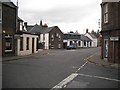
Laurencekirk
The High Street becomes Aberdeen Road at the junction with Alma Road and Station Road.
Image: © Richard Webb
Taken: 21 Sep 2009
0.05 miles
9
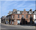
Corner block in Laurencekirk village centre
B-listed (LB43684) corner block at the junction of the High Street and Alma Place: http://portal.historicenvironment.scot/designation/LB43684 .
Image: © Bill Harrison
Taken: 21 Apr 2019
0.05 miles
10
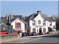
Royal Hotel, Laurencekirk
The slightly sprawling hotel in the centre of the village.
Image: © Bill Harrison
Taken: 21 Apr 2019
0.05 miles