Stirley Hill, Almondbury
Introduction
The photograph on this page of Stirley Hill, Almondbury by Humphrey Bolton as part of the Geograph project.
The Geograph project started in 2005 with the aim of publishing, organising and preserving representative images for every square kilometre of Great Britain, Ireland and the Isle of Man.

There are currently over 7.5m images from over 14,400 individuals and you can help contribute to the project by visiting https://www.geograph.org.uk
Stirley Hill, Almondbury
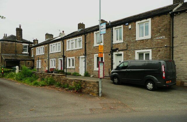
Image: © Humphrey Bolton Taken: 25 May 2023
This is a long row of terrace houses built in the countryside, mostly in the first half of the 19C (they are shown on the 1850 six-inch map, apart from the larger houses at the left of this image).
Images are licensed for reuse under creativecommons.org/licenses/by-sa/2.0
Image Location
Latitude
53.616942
Longitude
-1.779257