Houses, Brockweir
Introduction
The photograph on this page of Houses, Brockweir by Derek Harper as part of the Geograph project.
The Geograph project started in 2005 with the aim of publishing, organising and preserving representative images for every square kilometre of Great Britain, Ireland and the Isle of Man.

There are currently over 7.5m images from over 14,400 individuals and you can help contribute to the project by visiting https://www.geograph.org.uk
Houses, Brockweir
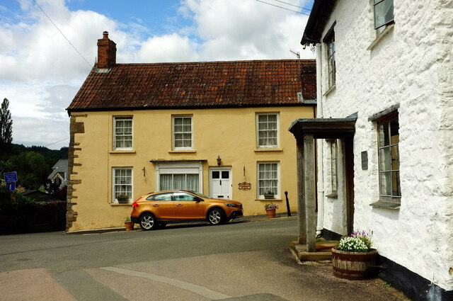
Image: © Derek Harper Taken: 25 Jun 2021
The grade II* listed Malt House https://historicengland.org.uk/listing/the-list/list-entry/1186590?section=official-list-entry on the right is shown in https://www.geograph.org.uk/search.php?i=161618229 . Across the street junction is Phoenix House, mapped as Severn House, formerly the Post Office : "...C16 ... Unprepossessing exterior conceals important historical fragments" (ouch) https://historicengland.org.uk/listing/the-list/list-entry/1186591?section=official-list-entry .
Images are licensed for reuse under creativecommons.org/licenses/by-sa/2.0
Image Location
Latitude
51.707187
Longitude
-2.667688