Soham: down the High Street
Introduction
The photograph on this page of Soham: down the High Street by John Sutton as part of the Geograph project.
The Geograph project started in 2005 with the aim of publishing, organising and preserving representative images for every square kilometre of Great Britain, Ireland and the Isle of Man.

There are currently over 7.5m images from over 14,400 individuals and you can help contribute to the project by visiting https://www.geograph.org.uk
Soham: down the High Street
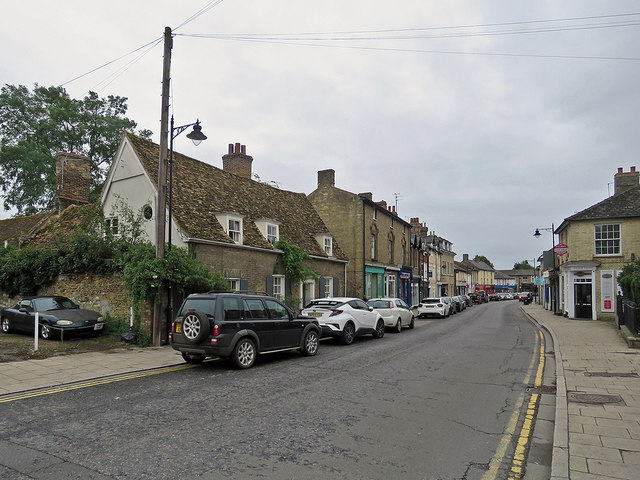
Image: © John Sutton Taken: 4 Oct 2019
A small town in the Cambridgeshire Fens, between Ely and Newmarket. The house on the left is Grade II listed: "Two cottages, now one, forming an L-plan. The front range was an open hall, C16, into which the floor and hearth were inserted in C17. In c 1840 the facade was cased in gault brick. Timber-framed, plaster-rendered with plain tile roof and tall early C18 red and gault brick stack to the side of the ridge. Three bays and now with lobby-entry plan. Three dormers and three recessed hung sashes with glazing bars. Circa 1840 doorcase of fluted pilasters with plain entablature and dentil cornice. The rear, originally a separate cottage, is C17 and also timber-framed and plaster-rendered. Plain tile roof with ridge stack."
Images are licensed for reuse under creativecommons.org/licenses/by-sa/2.0
Image Location
Latitude
52.332833
Longitude
0.337965