Old Toll House, Maesbury Road, Mile Oak
Introduction
The photograph on this page of Old Toll House, Maesbury Road, Mile Oak by Milestone Society as part of the Geograph project.
The Geograph project started in 2005 with the aim of publishing, organising and preserving representative images for every square kilometre of Great Britain, Ireland and the Isle of Man.

There are currently over 7.5m images from over 14,400 individuals and you can help contribute to the project by visiting https://www.geograph.org.uk
Old Toll House, Maesbury Road, Mile Oak
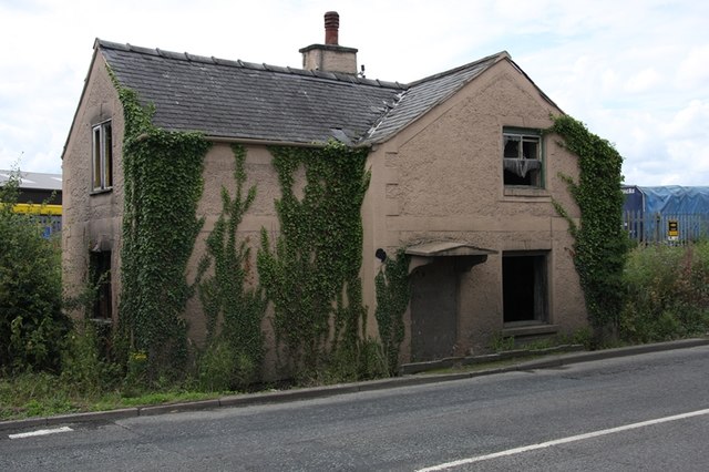
Image: © Milestone Society Taken: Unknown
Toll House by the A483, in the parish of Oswestry, Hollis House, Maesbury Road, Mile Oak. Shropshire HER. HER Number (PRN): 34213 https://www.heritagegateway.org.uk/Gateway/Results_Single.aspx?uid=MSA37163&resourceID=1015 Surveyed Milestone Society National ID: SA.OSW04
Images are licensed for reuse under creativecommons.org/licenses/by-sa/2.0
Image Location
Latitude
52.842674
Longitude
-3.039435