West Hill Drive, Mansfield, Notts.
Introduction
The photograph on this page of West Hill Drive, Mansfield, Notts. by David Hallam-Jones as part of the Geograph project.
The Geograph project started in 2005 with the aim of publishing, organising and preserving representative images for every square kilometre of Great Britain, Ireland and the Isle of Man.

There are currently over 7.5m images from over 14,400 individuals and you can help contribute to the project by visiting https://www.geograph.org.uk
West Hill Drive, Mansfield, Notts.
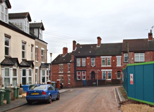
Image: © David Hallam-Jones Taken: 7 Jan 2017
West Hill Drive (ahead) is seen from one of several building site entrances. Inside this fence work continues apace on a project to build new homes for over-55s on the former Mansfield General Hospital site. This now-demolished hospital began with five beds in the early C19th and boasted 108 beds by 1890. Eric Sykes, the comedian, opened the last ward extension in 1950, a wing containing 60 beds. The hospital finally closed its doors in 1992, once the new King's Mill Hospital was opened, after which time it stood empty for over 20 years. West Hill Drive empties out - in both directions - into Chesterfield Road South (i.e. the A6009).
Images are licensed for reuse under creativecommons.org/licenses/by-sa/2.0
Image Location
Latitude
53.147295
Longitude
-1.195721