Junction, Totnes
Introduction
The photograph on this page of Junction, Totnes by Derek Harper as part of the Geograph project.
The Geograph project started in 2005 with the aim of publishing, organising and preserving representative images for every square kilometre of Great Britain, Ireland and the Isle of Man.

There are currently over 7.5m images from over 14,400 individuals and you can help contribute to the project by visiting https://www.geograph.org.uk
Junction, Totnes
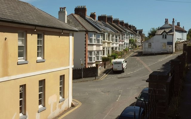
Image: © Derek Harper Taken: 23 Aug 2016
Below left is Lower Collins Road; in the centre is Antrim Terrace, and heading off to the right is Castle Street. On the left is the former Globe Inn, celebrated by the local band Pale Blue Eyes.
Images are licensed for reuse under creativecommons.org/licenses/by-sa/2.0
Image Location
Latitude
50.4335
Longitude
-3.690439