Buckland Church
Introduction
The photograph on this page of Buckland Church by Stefan Czapski as part of the Geograph project.
The Geograph project started in 2005 with the aim of publishing, organising and preserving representative images for every square kilometre of Great Britain, Ireland and the Isle of Man.

There are currently over 7.5m images from over 14,400 individuals and you can help contribute to the project by visiting https://www.geograph.org.uk
Buckland Church
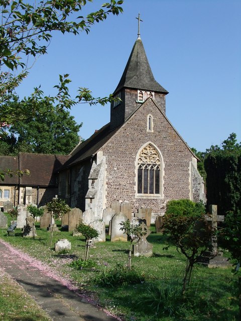
Image: © Stefan Czapski Taken: 25 Apr 2011
Though the church has medieval origins, Ian Nairn (writing in the Surrey volume of Pevsner's 'The Buildings of England') points out that what you see from outside dates from the 1860's. The stumpy shingled spire is typical of Surrey, and so is the main building material: Bargate stone. This is very much a local stone, probably quarried from the Lower Greensand formation at various spots around the county. Exactly where it got its name isn't clear, but I notice that 'Burgate' appears on the map at SU 98 38, in an area where Bargate stone is much used, near Hambledon. For a closer look at the use of Bargate stone in the west wall of the church, see Image
Images are licensed for reuse under creativecommons.org/licenses/by-sa/2.0
Image Location
Latitude
51.243209
Longitude
-0.250856