
ROADWORKS SUMMARY
Welton Road, BROUGH, HU15 1BH
Introduction
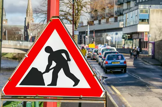
View current and future planned roadworks and road closures for Welton Road, HU15 1BH and the surrounding area.
Our roadwork details are constantly updated and reflect the current situation and we offer both a map view and a listing. We also highlight the major and significant roadworks occuring near to you help you avoid the worst of the delays to your journey.
The roadworks shown below show all current and proposed works during the next 90 days and historical data is recorded since July 2020.
Please note that we re-publish this data and cannot provide any additional information pertaining to a roadwork event. If you require more information, please contact the organisation carrying out the work.
Data are provided by the Department for Transport.
Have we helped today?
If we have helped you today, please consider buying us a quick coffee to keep us going!
Major Roadworks near to Welton Road, BROUGH, HU15 1BH
Details of major roadworks, currently in progress or starting soon and resulting in road closures and/or traffic signal management for Welton Road are shown here covering a 5 mile radius. See further down for details of all roadworks in your area.

23 Oct 2026
East Riding Of Yorkshire Council are carrying out Remedial works on Common Lane South, Welton.
These works are categorised as Major.
The road is closed for some or all of the period and could cause delays to journeys.
The works started on 12 May 2025 at 09:27 and could run through until 23 October 2026. The works will impact the footway and carriageway.
This roadwork event was last updated by East Riding Of Yorkshire Council on 27 Mar 2026 at 09:57.

25 Sep 2026
Northern Gas Networks are carrying out Utility repair and maintenance works on Brough Road, South Cave.
These works are categorised as Major.
Two-way signals are to be in place for some or all of the period and could cause delays to journeys.
The works started on 30 June 2026 at 12:00 and could run through until 25 September 2026. The works will impact the footway and carriageway.
This roadwork event was last updated by Northern Gas Networks on 2 Sep 2026 at 15:35.

Tomorrow
Northern Powergrid (Yorkshire) are carrying out New service connection on Cowgate, Welton.
These works are categorised as Major.
Multi-way signals are to be in place for some or all of the period and could cause delays to journeys.
The works started on 21 August 2026 at 10:30 and could run through until 18 September 2026. The works will impact the footway and carriageway.
This roadwork event was last updated by Northern Powergrid (Yorkshire) on 21 Aug 2026 at 12:29.

21 and 25 Sep 2026
North Lincolnshire Council are proposing to carry out Utility asset works on Winteringham Lane, West Halton.
These works are categorised as Major.
The road will be closed for some or all of the period and could cause delays to journeys.
The works will start on or after 21 September 2026 and could run through until 25 September 2026. The works will impact the carriageway only.
This roadwork event was last updated by North Lincolnshire Council on 5 Aug 2026 at 14:59.
12 Oct and 6 Nov 2026
North Lincolnshire Council are proposing to carry out Utility asset works on Mill House Lane, Winterton.
These works are categorised as Major.
The road will be closed for some or all of the period and could cause delays to journeys.
The works will start on or after 12 October 2026 and could run through until 6 November 2026. The works will impact the carriageway only.
This roadwork event was last updated by North Lincolnshire Council on 9 Jun 2026 at 15:51.
19 Oct and 18 Dec 2026
Northern Gas Networks are proposing to carry out Utility repair and maintenance works on Kemp Road, Swanland.
These works are categorised as Major.
Multi-way signals will be in place for some or all of the period and could cause delays to journeys.
The works will start on or after 19 October 2026 and could run through until 18 December 2026. The works will impact the footway and carriageway.
This roadwork event was last updated by Northern Gas Networks on 9 Sep 2026 at 12:34.
19 Oct and 27 Nov 2026
East Riding Of Yorkshire Council are proposing to carry out Highway improvement works on Mill Lane, Kirk Ella.
These works are categorised as Major.
The road will be closed for some or all of the period and could cause delays to journeys.
The works will start on or after 19 October 2026 and could run through until 27 November 2026. The works will impact the carriageway only.
This roadwork event was last updated by East Riding Of Yorkshire Council on 6 Aug 2026 at 12:38.

23 and 27 Oct 2026
National Highways are proposing to carry out Works for road purposes on Road From Ferriby High Road To Humber Field Roundabout, Hessle.
These works are categorised as Major.
The road will be closed for some or all of the period and could cause delays to journeys.
The works will start on or after 23 October 2026 and could run through until 27 October 2026. The works will impact the carriageway only.
This roadwork event was last updated by National Highways on 4 Sep 2026 at 09:46.
26 Oct and 18 Dec 2026
Northern Gas Networks are proposing to carry out Utility repair and maintenance works on Kemp Road, Swanland.
These works are categorised as Major.
Multi-way signals will be in place for some or all of the period and could cause delays to journeys.
The works will start on or after 26 October 2026 and could run through until 18 December 2026. The works will impact the footway and carriageway.
This roadwork event was last updated by Northern Gas Networks on 19 Aug 2026 at 10:16.

26 and 31 Oct 2026
Yorkshire Water are proposing to carry out Utility repair and maintenance works on Godmans Lane, Kirk Ella.
These works are categorised as Major.
The road will be closed for some or all of the period and could cause delays to journeys.
The works will start on or after 26 October 2026 and could run through until 31 October 2026. The works will impact the carriageway only.
This roadwork event was last updated by Yorkshire Water on 26 Aug 2026 at 12:19.
26 and 31 Oct 2026
Yorkshire Water are proposing to carry out Utility repair and maintenance works on Godmans Lane, Kirk Ella.
These works are categorised as Major.
The road will be closed for some or all of the period and could cause delays to journeys.
The works will start on or after 26 October 2026 and could run through until 31 October 2026. The works will impact the carriageway only.
This roadwork event was last updated by Yorkshire Water on 3 Sep 2026 at 09:04.
27 Oct and 2 Nov 2026
Yorkshire Water are proposing to carry out Utility repair and maintenance works on Welton Road, Brough.
These works are categorised as Major.
The road will be closed for some or all of the period and could cause delays to journeys.
The works will start on or after 27 October 2026 and could run through until 2 November 2026. The works will impact the footway and carriageway.
This roadwork event was last updated by Yorkshire Water on 19 Aug 2026 at 09:59.
27 Oct and 2 Nov 2026
Yorkshire Water are proposing to carry out Utility repair and maintenance works on Welton Road, Brough.
These works are categorised as Major.
The road will be closed for some or all of the period and could cause delays to journeys.
The works will start on or after 27 October 2026 and could run through until 2 November 2026. The works will impact the footway and carriageway.
This roadwork event was last updated by Yorkshire Water on 27 Aug 2026 at 09:09.
2 and 19 Nov 2026
Northern Powergrid (Yorkshire) are proposing to carry out Utility repair and maintenance works on Dale Road, Welton.
These works are categorised as Major.
The road will be closed for some or all of the period and could cause delays to journeys.
The works will start on or after 2 November 2026 and could run through until 19 November 2026. The works will impact the carriageway only.
This roadwork event was last updated by Northern Powergrid (Yorkshire) on 3 Sep 2026 at 14:31.
2 and 19 Nov 2026
Northern Powergrid (Yorkshire) are proposing to carry out Utility repair and maintenance works on Dale Road, Welton.
These works are categorised as Major.
The road will be closed for some or all of the period and could cause delays to journeys.
The works will start on or after 2 November 2026 and could run through until 19 November 2026. The works will impact the carriageway only.
This roadwork event was last updated by Northern Powergrid (Yorkshire) on 10 Sep 2026 at 12:04.
19 Nov and 4 Dec 2026
East Riding Of Yorkshire Council are proposing to carry out Highway improvement works on Ings Lane, South Cave.
These works are categorised as Major.
The road will be closed for some or all of the period and could cause delays to journeys.
The works will start on or after 19 November 2026 and could run through until 4 December 2026. The works will impact the carriageway and verge.
This roadwork event was last updated by East Riding Of Yorkshire Council on 11 Sep 2026 at 09:19.
20 Nov and 4 Dec 2026
East Riding Of Yorkshire Council are proposing to carry out Highway improvement works on Norfolk Bank Lane, Ellerker.
These works are categorised as Major.
The road will be closed for some or all of the period and could cause delays to journeys.
The works will start on or after 20 November 2026 and could run through until 4 December 2026. The works will impact the footway, carriageway and verge.
This roadwork event was last updated by East Riding Of Yorkshire Council on 28 Aug 2026 at 15:10.

8 and 11 Dec 2026
Quickline Commucations are proposing to carry out Utility asset works on Winterton Road, Winteringham.
These works are categorised as Major.
The road will be closed for some or all of the period and could cause delays to journeys.
The works will start on or after 8 December 2026 and could run through until 11 December 2026. The works will impact the footway, carriageway and verge.
This roadwork event was last updated by Quickline Commucations on 16 Sep 2026 at 13:32.
Roadworks Map near to Welton Road, BROUGH, HU15 1BH
- Any red lines indicate the extent of the works.
- Clicking on the map will re-centre to the selected point.
- Within 1 mile, all roadworks are displayed.
- Within 2-3 miles, standard, urgent and major roadworks are displayed.
- For 3-5 miles, only major roadworks are shown.
- The higher the marker number, the further away the roadworks are from the centre of the postcode.
- Where traffic camera videos or images are shown, no historical versions are retained. Once a new image or video becomes available it overwrites the previous version.
Roadworks Listing near to Welton Road, BROUGH, HU15 1BH (9 Events)
(Scheduled Dates)
(miles)
(Scheduled: 12 Sep 2026 - 18 Sep 2026)
(Scheduled: 14 Sep 2026 - 18 Sep 2026)
(Scheduled: 12 May 2025 - 23 Oct 2026)
(Scheduled: 20 Aug 2026 - 18 Sep 2026)
Contains public sector information licensed under the Open Government Licence v3.0.