Overview for Lightwood Road, STOKE-ON-TRENT, ST3 7HQ
Introduction
Stoke-on-Trent (often abbreviated to Stoke) is a city and unitary authority area in Staffordshire, England, with an area of 36 square miles (93 km2). In 2019, the city had an estimated population of 258,375. It is the largest settlement in Staffordshire and is surrounded by the towns of Newcastle-under-Lyme, Alsager, Kidsgrove and Biddulph, which form a conurbation around the city.
The city is polycentric, formed from the federation of six towns in 1910. It took its name from Stoke-upon-Trent where the main centre of government and the principal railway station in the district were located. Hanley is the primary commercial centre; the other four towns which form the city are Burslem, Tunstall, Longton and Fenton.
The home of the pottery industry in England, it is known as The Potteries. It is a centre for service industries and distribution centres; it formerly had a primarily heavy industry sector.
Summary for Lightwood Road, STOKE-ON-TRENT, ST3 7HQ
Roadworks near ST3 7HQ
Road Safety near ST3 7HQ
Details of personal injury accidents in and around Lightwood Road, ST3 7HQ that have been reported to Staffordshire Police over the past 20 years.
Traffic Levels near ST3 7HQ
View traffic levels near Lightwood Road, ST3 7HQ from official Department for Transport counts.
Images taken near to Lightwood Road, ST3 7HQ and the surrounding area
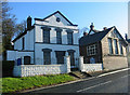
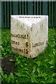
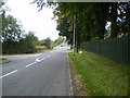
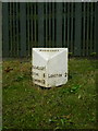
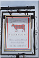
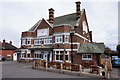
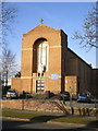
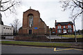
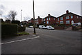
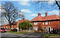
Please click the More button for more images, licensing and image copyright information.
Stoke-On-Trent and nearby Videos From YouTube
Alton towers from the air
Aerial footage from a Drone of The chained oak The smiler,Oblivion and The haunted manor Aka Duel Please Like,Subscribe and ...
Channel: Drone footage and various videos (View Channel)
Published: 30 Jan 2023
Police
This area is policed by Staffordshire Police.
Staffordshire Police split their policing area into 97 separate neighbourhoods and this postcode is in the Longton South neighbourhood.

Longton South Neighbourhood Crime
Top 3 Categories
For full details of all categories together with more crime information, click on the Details button.
Member of UK Parliament
This postcode is in the Stoke-on-Trent South parliamentary constituency.
Stoke-on-Trent South is a constituency in the West Midlands region of England. The seat has been held by Jack Brereton (Conservative) since June 2017.

Most Recent House Sales for Lightwood Road, ST3 7HQ
19 Dec 2019
27 Nov 2015
6 Jun 1997
Local Petrol Station Prices
Coordinates for ST3 7HQ
Residents at ST3 7HQ
Sunrise and Sunset at ST3 7HQ
Traffic Emission and Congestion Zones
Historical Weather Summary
| Clear | 19.13% |
| Cloudy | 63.41% |
| Rain | 6.93% |
| Windy | 10.45% |
| Other | 0.08% |
Population
Deprivation Index
the more deprived the postcode
Average Energy Performance
Companies Registered at ST3 7HQ
Postcode Details for ST3 7HQ
Recent Updates
|
18 Apr 2024 Added Traffic Camera Views from Traffic Scotland to Roadworks within Scotland |
|
15 Apr 2024 Schools Data updated for April 2024 |
|
10 Apr 2024 Companies Data updated for March 2024 |
|
7 Apr 2024 New option to receive automatic updates to roadworks that affect you |
|
7 Apr 2024 Police and Crime data updated for February 2024 |
|
3 Apr 2024 Sold House Price data updated for February 2024 |
|
30 Mar 2024 Energy Performance Certificates (England and Wales) updated February 2024 |
|
28 Mar 2024 New feature to use Geolocating functions to detect your current location |
Random Postcodes
Want an idea of what is in our extensive website? Try somewhere completely random!
The Rural/Urban classification is based upon data collected during the 2011 Census and released in August 2013 and is categorised into 6 distinct classes.
[A] Urban Major conurbation: A built up area with a population of 10,000 (3,000 in Scotland) or more and is assigned to the major conurbation settlement category.
[B] Urban Minor conurbation: A built up area with a population of 10,000 (3,000 in Scotland) or more and is assigned to the minor conurbation settlement category.
[C] Urban City and town: A built up area with a population of 10,000 (3,000 in Scotland) or more and is assigned to the city and town settlement category.
[D] Rural Town and fringe
[E] Rural Village
[F] Rural Hamlet and isolated dwelling
The Index of Multiple Deprivation (IMD) is the official measure of relative deprivation.
The index is based on 39 separate indicators across seven distinct domains (Income; Employment; Health and Disability; Education, Skills and Training; Crime; Barriers to Housing and Services; Living Environment) to provide an overall measure of multiple deprivation and is calculated for every neighbourhood.
The index is relative rather than an absolute scale and so a neighbourhood with a score of 10 is more deprived than one rated 20, but this does not equate to being twice as deprived.
Please note: Different indices are used in England, Scotland, Wales and Northern Ireland and so comparison of scores from neighbourhoods in different countries should not be undertaken.
These figures report on incorporated UK companies only that are registered at this postcode and do not include sole-traders, partnerships or overseas organisations.
The population figure shown for your area are an estimate provided by the Office for National Statistics and is rounded to the nearest 1,000.
The estimates are derived from the Annual Population Survey (APS) which is the Labour Force Survey (LFS) plus various sample boosts.
There are 55 unitary authorities. They provide all local government services in their areas. These are mainly in the cities, urban areas and larger towns although there are now 6 shire county councils that are unitary (ie have no district councils beneath them).