Overview for Tumblewood Road, BANSTEAD, SM7 1DS
Introduction
Banstead is a town in the borough of Reigate and Banstead in Surrey, England. It is 3 miles (5 km) south of Sutton, 5 miles (8 km) south-west of Croydon, 8 miles (13 km) south-east of Kingston-upon-Thames, and 13 miles (21 km) south of Central London.
On the North Downs, it is on three of the four main compass points separated from other settlements by open area buffers with Metropolitan Green Belt status. Banstead Downs, although a fragment of its larger historic area and spread between newer developments, is a Site of Special Scientific Interest (SSSI).
The civil parish of Banstead became part of the Epsom Rural Sanitary District on the district's creation in 1872, and continued as part of its successor, the Epsom Rural District, from 1894 to 1933. In that year the Banstead Urban District was created incorporating also the parishes of Chipstead, Kingswood, Walton on the Hill, and Woodmansterne. The civil parish was abolished, like other parishes in former urban districts, when (under the Local Government Act 1972) the Banstead Urban District was subsumed into the new Reigate and Banstead Borough in 1974. Both parish and urban district included many outlying parts as well as the main settlement. One of the Banstead wards is "Banstead Village". The contiguous ward of Nork, which contains Banstead station, shares in many amenities of Banstead and is included in county-level population analyses of Banstead but not the central-government-drawn Banstead Built-up Area. The latter takes in Burgh Heath and held 15,469 residents as at the 2011 census.
Summary for Tumblewood Road, BANSTEAD, SM7 1DS
Roadworks near SM7 1DS
Road Safety near SM7 1DS
Details of personal injury accidents in and around Tumblewood Road, SM7 1DS that have been reported to Surrey Police over the past 20 years.
Traffic Levels near SM7 1DS
View traffic levels near Tumblewood Road, SM7 1DS from official Department for Transport counts.
Images taken near to Tumblewood Road, SM7 1DS and the surrounding area

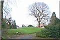

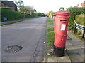
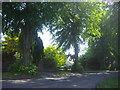
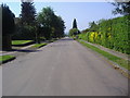
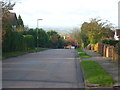
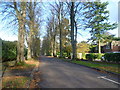
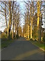
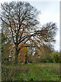
Please click the More button for more images, licensing and image copyright information.
Member of UK Parliament
This postcode is in the Epsom and Ewell parliamentary constituency.
Epsom and Ewell is a constituency in the South East region of England. The seat has been held by Chris Grayling (Conservative) since May 2010.

Most Recent House Sales for Tumblewood Road, SM7 1DS
28 Oct 2022
28 Nov 2019
6 Aug 2018
3 Nov 2016
Local Petrol Station Prices
Coordinates for SM7 1DS
Residents at SM7 1DS
Sunrise and Sunset at SM7 1DS
Traffic Emission and Congestion Zones
Historical Weather Summary
| Clear | 23.58% |
| Cloudy | 67.16% |
| Rain | 6.75% |
| Windy | 2.31% |
| Other | 0.20% |
Population
Deprivation Index
the more deprived the postcode
Average Energy Performance
Companies Registered at SM7 1DS
Postcode Details for SM7 1DS
Recent Updates
|
18 Apr 2024 Added Traffic Camera Views from Traffic Scotland to Roadworks within Scotland |
|
15 Apr 2024 Schools Data updated for April 2024 |
|
10 Apr 2024 Companies Data updated for March 2024 |
|
7 Apr 2024 New option to receive automatic updates to roadworks that affect you |
|
7 Apr 2024 Police and Crime data updated for February 2024 |
|
3 Apr 2024 Sold House Price data updated for February 2024 |
|
30 Mar 2024 Energy Performance Certificates (England and Wales) updated February 2024 |
|
28 Mar 2024 New feature to use Geolocating functions to detect your current location |
Random Postcodes
Want an idea of what is in our extensive website? Try somewhere completely random!
The Rural/Urban classification is based upon data collected during the 2011 Census and released in August 2013 and is categorised into 6 distinct classes.
[A] Urban Major conurbation: A built up area with a population of 10,000 (3,000 in Scotland) or more and is assigned to the major conurbation settlement category.
[B] Urban Minor conurbation: A built up area with a population of 10,000 (3,000 in Scotland) or more and is assigned to the minor conurbation settlement category.
[C] Urban City and town: A built up area with a population of 10,000 (3,000 in Scotland) or more and is assigned to the city and town settlement category.
[D] Rural Town and fringe
[E] Rural Village
[F] Rural Hamlet and isolated dwelling
The Index of Multiple Deprivation (IMD) is the official measure of relative deprivation.
The index is based on 39 separate indicators across seven distinct domains (Income; Employment; Health and Disability; Education, Skills and Training; Crime; Barriers to Housing and Services; Living Environment) to provide an overall measure of multiple deprivation and is calculated for every neighbourhood.
The index is relative rather than an absolute scale and so a neighbourhood with a score of 10 is more deprived than one rated 20, but this does not equate to being twice as deprived.
Please note: Different indices are used in England, Scotland, Wales and Northern Ireland and so comparison of scores from neighbourhoods in different countries should not be undertaken.
These figures report on incorporated UK companies only that are registered at this postcode and do not include sole-traders, partnerships or overseas organisations.
The population figure shown for your area are an estimate provided by the Office for National Statistics and is rounded to the nearest 1,000.
The estimates are derived from the Annual Population Survey (APS) which is the Labour Force Survey (LFS) plus various sample boosts.
There are 26 county councils in 2-tier areas, providing services such as education, social services and waste disposal.
In 2-tier areas, each county council area is subdivided into districts, for which there is an independent district council. There are 192 district councils.
District councils are responsible for local services such as rubbish collection, housing and planning applications.