Overview for Stevenson Drive, ROTHERHAM, S65 2LF
Introduction
Rotherham (RODH-ər-əm) is a minster town in South Yorkshire, England. It is the largest settlement in the Metropolitan Borough of Rotherham. Rotherham is named after the River Rother, one of two major rivers (the other being the River Don) to flow through the town.
Prior to the industrial revolution, traditional industries included farming, glass making and flour milling. In the late 18th and 19th centuries, Rotherham became known for its coal mining and, later, steel industries.
The town's historic county is Yorkshire, and Rotherham once formed part of the West Riding of Yorkshire administrative county. In 1974, this administrative county was abolished during a reorganisation of local government. Subsequently, Rotherham became part of the county of South Yorkshire, where it makes up one of four metropolitan boroughs.
The town had a population of 109,691 in the 2011 census. The borough had a 2021 population of 265,807, the 61st most populous district in England.
Summary for Stevenson Drive, ROTHERHAM, S65 2LF
Roadworks near S65 2LF
Road Safety near S65 2LF
Details of personal injury accidents in and around Stevenson Drive, S65 2LF that have been reported to South Yorkshire Police over the past 20 years.
Traffic Levels near S65 2LF
View traffic levels near Stevenson Drive, S65 2LF from official Department for Transport counts.
Images taken near to Stevenson Drive, S65 2LF and the surrounding area
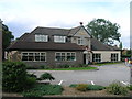
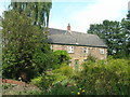
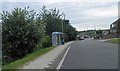
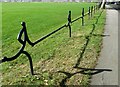
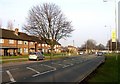
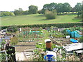
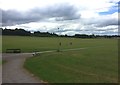
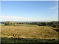
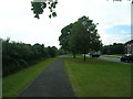
Please click the More button for more images, licensing and image copyright information.
Rotherham and nearby Videos From YouTube
Conisbrough Castle
Ariel tour of Conisbrough Castle on a nice sunny April evening. Enjoy.
Channel: Epic Drone Tours (View Channel)
Published: 6 Apr 2021
Police
This area is policed by South Yorkshire Police.
South Yorkshire Police split their policing area into 18 separate neighbourhoods and this postcode is in the Rotherham North neighbourhood.

Rotherham North Neighbourhood Crime
Top 3 Categories
For full details of all categories together with more crime information, click on the Details button.
Member of UK Parliament
This postcode is in the Rotherham parliamentary constituency.
Rotherham is a constituency in the Yorkshire and The Humber region of England. The seat has been held by Sarah Champion (Labour) since November 2012.

Most Recent House Sales for Stevenson Drive, S65 2LF
28 May 2021
3 Feb 2017
3 Sep 2002
4 Dec 2000
Local Petrol Station Prices
Coordinates for S65 2LF
Residents at S65 2LF
Sunrise and Sunset at S65 2LF
Traffic Emission and Congestion Zones
Historical Weather Summary
| Clear | 10.79% |
| Cloudy | 74.61% |
| Rain | 7.53% |
| Windy | 6.61% |
| Other | 0.46% |
Population
Deprivation Index
the more deprived the postcode
Average Energy Performance
Companies Registered at S65 2LF
Postcode Details for S65 2LF
Recent Updates
|
18 Apr 2024 Added Traffic Camera Views from Traffic Scotland to Roadworks within Scotland |
|
15 Apr 2024 Schools Data updated for April 2024 |
|
10 Apr 2024 Companies Data updated for March 2024 |
|
7 Apr 2024 New option to receive automatic updates to roadworks that affect you |
|
7 Apr 2024 Police and Crime data updated for February 2024 |
|
3 Apr 2024 Sold House Price data updated for February 2024 |
|
30 Mar 2024 Energy Performance Certificates (England and Wales) updated February 2024 |
|
28 Mar 2024 New feature to use Geolocating functions to detect your current location |
Random Postcodes
Want an idea of what is in our extensive website? Try somewhere completely random!
The Rural/Urban classification is based upon data collected during the 2011 Census and released in August 2013 and is categorised into 6 distinct classes.
[A] Urban Major conurbation: A built up area with a population of 10,000 (3,000 in Scotland) or more and is assigned to the major conurbation settlement category.
[B] Urban Minor conurbation: A built up area with a population of 10,000 (3,000 in Scotland) or more and is assigned to the minor conurbation settlement category.
[C] Urban City and town: A built up area with a population of 10,000 (3,000 in Scotland) or more and is assigned to the city and town settlement category.
[D] Rural Town and fringe
[E] Rural Village
[F] Rural Hamlet and isolated dwelling
The Index of Multiple Deprivation (IMD) is the official measure of relative deprivation.
The index is based on 39 separate indicators across seven distinct domains (Income; Employment; Health and Disability; Education, Skills and Training; Crime; Barriers to Housing and Services; Living Environment) to provide an overall measure of multiple deprivation and is calculated for every neighbourhood.
The index is relative rather than an absolute scale and so a neighbourhood with a score of 10 is more deprived than one rated 20, but this does not equate to being twice as deprived.
Please note: Different indices are used in England, Scotland, Wales and Northern Ireland and so comparison of scores from neighbourhoods in different countries should not be undertaken.
These figures report on incorporated UK companies only that are registered at this postcode and do not include sole-traders, partnerships or overseas organisations.
The population figure shown for your area are an estimate provided by the Office for National Statistics and is rounded to the nearest 1,000.
The estimates are derived from the Annual Population Survey (APS) which is the Labour Force Survey (LFS) plus various sample boosts.
There are 36 metropolitan district councils which together cover 6 large urban areas: the counties of Greater Manchester, Merseyside, South Yorkshire, Tyne and Wear, West Midlands, and West Yorkshire.
Metropolitan districts are responsible for all services in their area, although certain conurbation wide services such as fire and civil defence, police, waste disposal and passenger transport are provided through joint authorities (the districts acting jointly).