Overview for Blanks Lane, DORKING, RH5 5ED
Introduction
Dorking is a market town in Surrey in South East England, about 21 mi (34 km) south of London. It is in Mole Valley District and the council headquarters are to the east of the centre. The High Street runs roughly east–west, parallel to the Pipp Brook and along the northern face of an outcrop of Lower Greensand. The town is surrounded on three sides by the Surrey Hills Area of Outstanding Natural Beauty and is close to Box Hill and Leith Hill.
The earliest archaeological evidence of human activity is from the Mesolithic and Neolithic periods, and there are several Bronze Age bowl barrows in the local area. The town may have been the site of a staging post on Stane Street during Roman times, however the name 'Dorking' suggests an Anglo-Saxon origin for the modern settlement. A market is thought to have been held at least weekly since early medieval times and was highly regarded for the poultry traded there. The Dorking breed of domestic chicken is named after the town.
The local economy thrived during Tudor times, but declined in the 17th century due to poor infrastructure and competition from neighbouring towns. During the early modern period many inhabitants were nonconformists, including the author, Daniel Defoe, who lived in Dorking as a child. Six of the Mayflower Pilgrims, including William Mullins and his daughter Priscilla, lived in the town before setting sail for the New World.
Dorking started to expand during the 18th and 19th centuries as transport links improved and farmland to the south of the centre was released for housebuilding. The new turnpike, and later the railways, facilitated the sale of lime produced in the town, but also attracted wealthier residents, who had had no previous connection to the area. Residential expansion continued in the first half of the 20th century, as the Deepdene and Denbies estates began to be broken up. Further development is now constrained by the Metropolitan Green Belt, which encircles the town.
Summary for Blanks Lane, DORKING, RH5 5ED
Roadworks near RH5 5ED
Road Safety near RH5 5ED
Details of personal injury accidents in and around Blanks Lane, RH5 5ED that have been reported to Surrey Police over the past 20 years.
Traffic Levels near RH5 5ED
View traffic levels near Blanks Lane, RH5 5ED from official Department for Transport counts.
Images taken near to Blanks Lane, RH5 5ED and the surrounding area
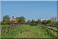
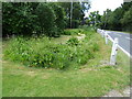
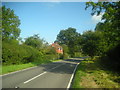
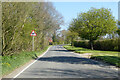
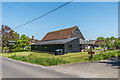
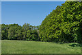
Please click the More button for more images, licensing and image copyright information.
Member of UK Parliament
This postcode is in the Mole Valley parliamentary constituency.
Mole Valley is a constituency in the South East region of England. The seat has been held by Sir Paul Beresford (Conservative) since May 2010.

Most Recent House Sales for Blanks Lane, RH5 5ED
17 Jul 2020
17 Mar 2015
Local Petrol Station Prices
Coordinates for RH5 5ED
Residents at RH5 5ED
Sunrise and Sunset at RH5 5ED
Traffic Emission and Congestion Zones
Historical Weather Summary
| Clear | 22.37% |
| Cloudy | 62.71% |
| Rain | 7.07% |
| Windy | 7.66% |
| Other | 0.19% |
Population
Deprivation Index
the more deprived the postcode
Average Energy Performance
Companies Registered at RH5 5ED
Postcode Details for RH5 5ED
Recent Updates
|
18 Apr 2024 Added Traffic Camera Views from Traffic Scotland to Roadworks within Scotland |
|
15 Apr 2024 Schools Data updated for April 2024 |
|
10 Apr 2024 Companies Data updated for March 2024 |
|
7 Apr 2024 New option to receive automatic updates to roadworks that affect you |
|
7 Apr 2024 Police and Crime data updated for February 2024 |
|
3 Apr 2024 Sold House Price data updated for February 2024 |
|
30 Mar 2024 Energy Performance Certificates (England and Wales) updated February 2024 |
|
28 Mar 2024 New feature to use Geolocating functions to detect your current location |
Random Postcodes
Want an idea of what is in our extensive website? Try somewhere completely random!
The Rural/Urban classification is based upon data collected during the 2011 Census and released in August 2013 and is categorised into 6 distinct classes.
[A] Urban Major conurbation: A built up area with a population of 10,000 (3,000 in Scotland) or more and is assigned to the major conurbation settlement category.
[B] Urban Minor conurbation: A built up area with a population of 10,000 (3,000 in Scotland) or more and is assigned to the minor conurbation settlement category.
[C] Urban City and town: A built up area with a population of 10,000 (3,000 in Scotland) or more and is assigned to the city and town settlement category.
[D] Rural Town and fringe
[E] Rural Village
[F] Rural Hamlet and isolated dwelling
The Index of Multiple Deprivation (IMD) is the official measure of relative deprivation.
The index is based on 39 separate indicators across seven distinct domains (Income; Employment; Health and Disability; Education, Skills and Training; Crime; Barriers to Housing and Services; Living Environment) to provide an overall measure of multiple deprivation and is calculated for every neighbourhood.
The index is relative rather than an absolute scale and so a neighbourhood with a score of 10 is more deprived than one rated 20, but this does not equate to being twice as deprived.
Please note: Different indices are used in England, Scotland, Wales and Northern Ireland and so comparison of scores from neighbourhoods in different countries should not be undertaken.
These figures report on incorporated UK companies only that are registered at this postcode and do not include sole-traders, partnerships or overseas organisations.
The population figure shown for your area are an estimate provided by the Office for National Statistics and is rounded to the nearest 1,000.
The estimates are derived from the Annual Population Survey (APS) which is the Labour Force Survey (LFS) plus various sample boosts.
There are 26 county councils in 2-tier areas, providing services such as education, social services and waste disposal.
In 2-tier areas, each county council area is subdivided into districts, for which there is an independent district council. There are 192 district councils.
District councils are responsible for local services such as rubbish collection, housing and planning applications.