Halesbridge Farm
Introduction
The photograph on this page of Halesbridge Farm by Ian Capper as part of the Geograph project.
The Geograph project started in 2005 with the aim of publishing, organising and preserving representative images for every square kilometre of Great Britain, Ireland and the Isle of Man.

There are currently over 7.5m images from over 14,400 individuals and you can help contribute to the project by visiting https://www.geograph.org.uk
Halesbridge Farm
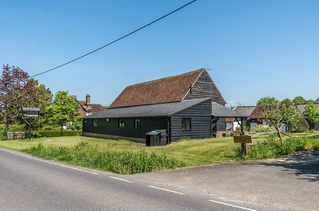
Image: © Ian Capper Taken: 20 May 2018
Farm on Blanks Lane. The barn is of 17th and 19th Century origin (with the section nearest the road added in the 20th Century) and the farmhouse (in the left background) dates originally from the 17th Century. Both are grade II listed - see www.historicengland.org.uk/listing/the-list/list-entry/1378139 and www.historicengland.org.uk/listing/the-list/list-entry/1028714 respectively.
Images are licensed for reuse under creativecommons.org/licenses/by-sa/2.0
Image Location
Latitude
51.176156
Longitude
-0.256728