Overview for Norwood Road, HUDDERSFIELD, HD2 2YF
Introduction
Huddersfield is a market town in the Kirklees district in West Yorkshire, England. It is the administrative centre and largest settlement in the Kirklees district. The town is in the foothills of the Pennines. The River Holme's confluence into the similar-sized Colne is to the south of the town centre which then flows into the Calder in the north eastern outskirts of the town.
The rivers around the town provided soft water required for textile treatment in large weaving sheds, this made it a prominent mill town with an economic boom in the early part of the Victorian era Industrial Revolution. The town centre has much neoclassical Victorian architecture, one example is its railway station which is a Grade I listed building – described by John Betjeman as "the most splendid station façade in England" –
and won the Europa Nostra award for architecture.
It hosts the University of Huddersfield and three colleges: Greenhead College, Kirklees College and Huddersfield New College. The town is the birthplace of rugby league with the local team, Huddersfield Giants, playing in the Super League. It also has a professional football team called Huddersfield Town, who currently compete in the Championship, as well as two Rugby Union clubs Huddersfield R.
U.
F.
C. and Huddersfield YM RUFC. Notable people from the town include twice British Prime Minister Harold Wilson (for Labour), film star James Mason born in the town and Jodie Whittaker, the 13th actor to play Doctor Who, was born in Skelmanthorpe.
The town has been classed under Yorkshire, the West Riding of Yorkshire and West Yorkshire for statistics throughout its history. The town's population in 1961 was 130,652 with an increase to 162,949 at the 2011 census; it is in the West Yorkshire Built-up Area. The town is 14 miles (23 km) south-west of Leeds, 12 miles (19 km) west of Wakefield, 23 miles (37 km) north-west of Sheffield and 24 miles (39 km) north-east of Manchester.
Summary for Norwood Road, HUDDERSFIELD, HD2 2YF
Roadworks near HD2 2YF
Road Safety near HD2 2YF
Details of personal injury accidents in and around Norwood Road, HD2 2YF that have been reported to West Yorkshire Police over the past 20 years.
Traffic Levels near HD2 2YF
View traffic levels near Norwood Road, HD2 2YF from official Department for Transport counts.
Images taken near to Norwood Road, HD2 2YF and the surrounding area
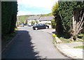
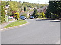
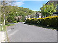
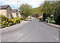
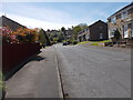
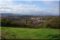
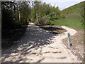
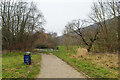
Please click the More button for more images, licensing and image copyright information.
Huddersfield and nearby Videos From YouTube
Birds Eye View of Meltham, Huddersfield.mp4
Channel: The Flight Stuff (View Channel)
Published: 24 Mar 2023
Police
This area is policed by West Yorkshire Police.
West Yorkshire Police split their policing area into 21 separate neighbourhoods and this postcode is in the Huddersfield neighbourhood.

Huddersfield Neighbourhood Crime
Top 3 Categories
For full details of all categories together with more crime information, click on the Details button.
Member of UK Parliament
This postcode is in the Huddersfield parliamentary constituency.
Huddersfield is a constituency in the Yorkshire and The Humber region of England. The seat has been held by Mr Barry Sheerman (Labour) since May 2010.

Most Recent House Sales for Norwood Road, HD2 2YF
15 Feb 2023
3 Oct 2022
14 May 2021
14 Apr 2021
Local Petrol Station Prices
Coordinates for HD2 2YF
Residents at HD2 2YF
Sunrise and Sunset at HD2 2YF
Traffic Emission and Congestion Zones
Historical Weather Summary
| Clear | 7.54% |
| Cloudy | 60.16% |
| Rain | 10.31% |
| Windy | 20.65% |
| Other | 1.34% |
Population
Deprivation Index
the more deprived the postcode
Average Energy Performance
Companies Registered at HD2 2YF
Postcode Details for HD2 2YF
Recent Updates
|
18 Apr 2024 Added Traffic Camera Views from Traffic Scotland to Roadworks within Scotland |
|
15 Apr 2024 Schools Data updated for April 2024 |
|
10 Apr 2024 Companies Data updated for March 2024 |
|
7 Apr 2024 New option to receive automatic updates to roadworks that affect you |
|
7 Apr 2024 Police and Crime data updated for February 2024 |
|
3 Apr 2024 Sold House Price data updated for February 2024 |
|
30 Mar 2024 Energy Performance Certificates (England and Wales) updated February 2024 |
|
28 Mar 2024 New feature to use Geolocating functions to detect your current location |
Random Postcodes
Want an idea of what is in our extensive website? Try somewhere completely random!
The Rural/Urban classification is based upon data collected during the 2011 Census and released in August 2013 and is categorised into 6 distinct classes.
[A] Urban Major conurbation: A built up area with a population of 10,000 (3,000 in Scotland) or more and is assigned to the major conurbation settlement category.
[B] Urban Minor conurbation: A built up area with a population of 10,000 (3,000 in Scotland) or more and is assigned to the minor conurbation settlement category.
[C] Urban City and town: A built up area with a population of 10,000 (3,000 in Scotland) or more and is assigned to the city and town settlement category.
[D] Rural Town and fringe
[E] Rural Village
[F] Rural Hamlet and isolated dwelling
The Index of Multiple Deprivation (IMD) is the official measure of relative deprivation.
The index is based on 39 separate indicators across seven distinct domains (Income; Employment; Health and Disability; Education, Skills and Training; Crime; Barriers to Housing and Services; Living Environment) to provide an overall measure of multiple deprivation and is calculated for every neighbourhood.
The index is relative rather than an absolute scale and so a neighbourhood with a score of 10 is more deprived than one rated 20, but this does not equate to being twice as deprived.
Please note: Different indices are used in England, Scotland, Wales and Northern Ireland and so comparison of scores from neighbourhoods in different countries should not be undertaken.
These figures report on incorporated UK companies only that are registered at this postcode and do not include sole-traders, partnerships or overseas organisations.
The population figure shown for your area are an estimate provided by the Office for National Statistics and is rounded to the nearest 1,000.
The estimates are derived from the Annual Population Survey (APS) which is the Labour Force Survey (LFS) plus various sample boosts.
There are 36 metropolitan district councils which together cover 6 large urban areas: the counties of Greater Manchester, Merseyside, South Yorkshire, Tyne and Wear, West Midlands, and West Yorkshire.
Metropolitan districts are responsible for all services in their area, although certain conurbation wide services such as fire and civil defence, police, waste disposal and passenger transport are provided through joint authorities (the districts acting jointly).