Overview for The Warren, ABINGDON, OX14 3XB
Introduction
Abingdon-on-Thames (AB-ing-dən), commonly known as Abingdon, is a historic market town and civil parish in the ceremonial county of Oxfordshire, England, on the River Thames. Historically the county town of Berkshire, Abingdon has been administered since 1974 by the Vale of White Horse district within Oxfordshire. The area was occupied from the early to middle Iron Age and the remains of a late Iron Age and Roman defensive enclosure lies below the town centre. Abingdon Abbey was founded around 676, giving its name to the emerging town. In the 13th and 14th centuries, Abingdon was an agricultural centre with an extensive trade in wool, alongside weaving and the manufacture of clothing. Charters for the holding of markets and fairs were granted by various monarchs, from Edward I to George II.
The town survived the dissolution of the abbey in 1538, and by the 18th and 19th centuries, with the building of Abingdon Lock in 1790 and the Wilts & Berks Canal in 1810, Abingdon was on important routes for goods transport. In 1856 the Abingdon Railway opened, linking the town with the Great Western Railway. The canal was abandoned in 1906 but a voluntary trust is now working to restore and re-open it. Abingdon railway station was closed to passengers in September 1963. The line remained open for goods until 1984, its role including serving the MG car factory, which operated from 1929 to 1980.
Abingdon's brewery, Morland, makers of Old Speckled Hen ale, was taken over and closed in 1999; the site of the brewery has been redeveloped into housing. The rock band Radiohead formed in 1985 when its members were studying at Abingdon School, a day and boarding independent secondary school. The 2011 Census recorded the parish's population as 33,130. This was 2,504 more than in the 2001 Census total of 30,626, and represented just over 8% growth in the population.
Summary for The Warren, ABINGDON, OX14 3XB
Roadworks near OX14 3XB
Road Safety near OX14 3XB
Details of personal injury accidents in and around The Warren, OX14 3XB that have been reported to Thames Valley Police over the past 20 years.
Traffic Levels near OX14 3XB
View traffic levels near The Warren, OX14 3XB from official Department for Transport counts.
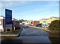
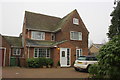
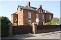
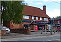
Images taken near to The Warren, OX14 3XB and the surrounding area
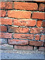
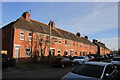
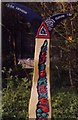
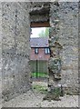
Please click the More button for more images, licensing and image copyright information.
Police
This area is policed by Thames Valley Police.
Thames Valley Police split their policing area into 108 separate neighbourhoods and this postcode is in the Abingdon Town neighbourhood.

Abingdon Town Neighbourhood Crime
Top 3 Categories
For full details of all categories together with more crime information, click on the Details button.
Member of UK Parliament
This postcode is in the Oxford West and Abingdon parliamentary constituency.
Oxford West and Abingdon is a constituency in the South East region of England. The seat has been held by Layla Moran (Liberal Democrat) since June 2017.

Most Recent House Sales for The Warren, OX14 3XB
22 Nov 2023
26 Nov 2020
11 May 2018
22 Aug 2017
Local Petrol Station Prices
Coordinates for OX14 3XB
Residents at OX14 3XB
Sunrise and Sunset at OX14 3XB
Traffic Emission and Congestion Zones
Historical Weather Summary
| Clear | 21.35% |
| Cloudy | 68.97% |
| Rain | 6.33% |
| Windy | 3.21% |
| Other | 0.14% |
Population
Deprivation Index
the more deprived the postcode
Average Energy Performance
Companies Registered at OX14 3XB
Postcode Details for OX14 3XB
Recent Updates
|
18 Apr 2024 Added Traffic Camera Views from Traffic Scotland to Roadworks within Scotland |
|
15 Apr 2024 Schools Data updated for April 2024 |
|
10 Apr 2024 Companies Data updated for March 2024 |
|
7 Apr 2024 New option to receive automatic updates to roadworks that affect you |
|
7 Apr 2024 Police and Crime data updated for February 2024 |
|
3 Apr 2024 Sold House Price data updated for February 2024 |
|
30 Mar 2024 Energy Performance Certificates (England and Wales) updated February 2024 |
|
28 Mar 2024 New feature to use Geolocating functions to detect your current location |
Random Postcodes
Want an idea of what is in our extensive website? Try somewhere completely random!
The Rural/Urban classification is based upon data collected during the 2011 Census and released in August 2013 and is categorised into 6 distinct classes.
[A] Urban Major conurbation: A built up area with a population of 10,000 (3,000 in Scotland) or more and is assigned to the major conurbation settlement category.
[B] Urban Minor conurbation: A built up area with a population of 10,000 (3,000 in Scotland) or more and is assigned to the minor conurbation settlement category.
[C] Urban City and town: A built up area with a population of 10,000 (3,000 in Scotland) or more and is assigned to the city and town settlement category.
[D] Rural Town and fringe
[E] Rural Village
[F] Rural Hamlet and isolated dwelling
The Index of Multiple Deprivation (IMD) is the official measure of relative deprivation.
The index is based on 39 separate indicators across seven distinct domains (Income; Employment; Health and Disability; Education, Skills and Training; Crime; Barriers to Housing and Services; Living Environment) to provide an overall measure of multiple deprivation and is calculated for every neighbourhood.
The index is relative rather than an absolute scale and so a neighbourhood with a score of 10 is more deprived than one rated 20, but this does not equate to being twice as deprived.
Please note: Different indices are used in England, Scotland, Wales and Northern Ireland and so comparison of scores from neighbourhoods in different countries should not be undertaken.
These figures report on incorporated UK companies only that are registered at this postcode and do not include sole-traders, partnerships or overseas organisations.
The population figure shown for your area are an estimate provided by the Office for National Statistics and is rounded to the nearest 1,000.
The estimates are derived from the Annual Population Survey (APS) which is the Labour Force Survey (LFS) plus various sample boosts.
There are 26 county councils in 2-tier areas, providing services such as education, social services and waste disposal.
In 2-tier areas, each county council area is subdivided into districts, for which there is an independent district council. There are 192 district councils.
District councils are responsible for local services such as rubbish collection, housing and planning applications.