
IMAGES TAKEN NEAR TO
Grouse Close, YO7 3FZ
Introduction
This page details the photographs taken nearby to Grouse Close, YO7 3FZ by members of the Geograph project.
The Geograph project started in 2005 with the aim of publishing, organising and preserving representative images for every square kilometre of Great Britain, Ireland and the Isle of Man.

There are currently over 7.5m images from over14,400 individuals and you can help contribute to the project by visiting https://www.geograph.org.uk
Image Map
Images are licensed for reuse under creativecommons.org/licenses/by-sa/2.0
Notes
- Clicking on the map will re-center to the selected point.
- The higher the marker number, the further away the image location is from the centre of the postcode.
Image Listing (20 Images Found)
Images are licensed for reuse under creativecommons.org/licenses/by-sa/2.0
Image
Details
Distance
1
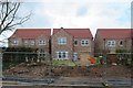
New development, Dishforth
This is not the only development in Dishforth in 2020 as the village expands, due no doubt to its proximity to the major road system. One wonders how the two executive properties in the centre and left of this shot were built quite so close together.
Image: © Gordon Hatton
Taken: 3 Apr 2020
0.05 miles
2
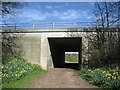
Bridleway under the A168
Walkers and riders leaving Dishforth for Topcliffe would take this route under the A168 - a dual carriageway that speeds traffic to the north of the village
Image: © Chris Heaton
Taken: 4 Apr 2007
0.07 miles
3
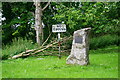
Millennium Stone
To celebrate the Millennium, children & residents of Dishforth planted 45 trees and 1,000 bulbs. Let's hope the trees don't now only number 44.
Image: © David Rogers
Taken: 25 Jun 2008
0.10 miles
4
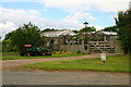
Dishforth Nursery Gardens
These Nursery Gardens are on Topcliffe Road in Dishforth.
Image: © David Rogers
Taken: 25 Jun 2008
0.11 miles
5
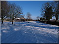
The road to nowhere
Dishforth has become a 'dead end' village since 1970 when this road [Topcliffe Road] was abandoned in favour of a new dual carriageway [A168]. Fifty years ago this was the A167, which began at Green Hammerton and made its way northwards via Boroughbridge, Dishforth [with an interruption at the WW2 airfield], Topcliffe and Northallerton to Darlington.
The buildings on the left are part of Dishforth Garden Centre.
Image: © Gordon Hatton
Taken: 8 Jan 2010
0.12 miles
6
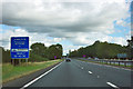
A168 road maintenance sign
The sign says it all.
Image: © Robin Webster
Taken: 7 Oct 2011
0.13 miles
7
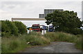
Road Closed
Vehicles travelling south along the A168 viewed from a road to nowhere in Dishforth village.
Image: © David Rogers
Taken: 25 Jun 2008
0.15 miles
8
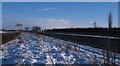
A168 at Dishforth
Traffic speeding along the A168 dual carriageway at Dishforth. The wintry conditions had caused a 30mph speed limit to be imposed on this section earlier the same morning.
Image: © Gordon Hatton
Taken: 8 Jan 2010
0.17 miles
10
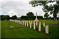
Dishforth Cemetery
The cemetery is just north of the village and not far from the former R.A.F. Station at Dishforth (since 1988 an Army Air Corps base). It contains 78 burials of the 1939-1945 War, of whom all were airmen and the majority belonged to the Royal Canadian Air Force. Many of the Canadian airmen buried here were stationed at Dishforth, the airfield having been used by No. 6 (R.C.A.F.) Bomber Group.
Image: © David Rogers
Taken: 25 Jun 2008
0.18 miles