
IMAGES TAKEN NEAR TO
Cowesby, THIRSK, YO7 2JJ
Introduction
This page details the photographs taken nearby to YO7 2JJ by members of the Geograph project.
The Geograph project started in 2005 with the aim of publishing, organising and preserving representative images for every square kilometre of Great Britain, Ireland and the Isle of Man.

There are currently over 7.5m images from over14,400 individuals and you can help contribute to the project by visiting https://www.geograph.org.uk
Image Map
Images are licensed for reuse under creativecommons.org/licenses/by-sa/2.0
Notes
- Clicking on the map will re-center to the selected point.
- The higher the marker number, the further away the image location is from the centre of the postcode.
Image Listing (10 Images Found)
Images are licensed for reuse under creativecommons.org/licenses/by-sa/2.0
Image
Details
Distance
1
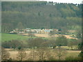
Cowesby Hall
The hall had only recently changed ownership and was undergoing major renovation
Image: © Nick W
Taken: 3 Apr 2003
0.02 miles
2
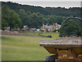
Cowesby Hall
Once again major building work is underway at present.
Image: © Colin Grice
Taken: 4 Aug 2013
0.05 miles
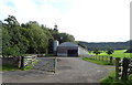
4
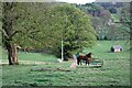
Looking Down Ruddings Lane
From behind Home Farm.
Image: © Mick Garratt
Taken: 17 Apr 2007
0.20 miles
5
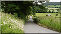
Minor road south-east of Cowesby
Cowesby is a small village at the foot of the western slope of the North Yorks Moors.
Image: © Trevor Littlewood
Taken: 3 Jul 2012
0.21 miles
6
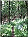
Woodland path
This is the path that descends the south flank of Pen Hill to Cowesby, passing through mixed woodland on the Cowesby Hall estate.
Image: © Gordon Hatton
Taken: 19 Jun 2019
0.22 miles
8
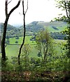
View through the trees above Cowesby Hall
Cowesby Hall is hidden down below, but the view from the hill extends south towards the prominent gap through which runs the Cowesby to Kirby Knowle road, this gap being created, or overdeepened by glacial meltwaters some 17000 years ago. To the right is the outlying hill which bears no name on OS maps, but is generally known as Woolmoor locally after a farm which once stood on its summit plateau.
Image: © Gordon Hatton
Taken: 19 Jun 2019
0.23 miles
9
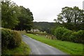
Ruddings Lane, Cowesby
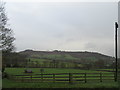
Like Keppwick over the hill, a bite out of the escarpment is occupied by a big house and big park.
Image: © Richard Webb
Taken: 11 Aug 2016
0.24 miles
10
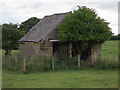
Curious field barn
This little building seems rather too well built to have been only a barn, so may have had some other purpose than a field shelter or store.
Image: © Colin Grice
Taken: 4 Aug 2013
0.25 miles