
View through the trees above Cowesby Hall
Introduction
The photograph on this page of View through the trees above Cowesby Hall by Gordon Hatton as part of the Geograph project.
The Geograph project started in 2005 with the aim of publishing, organising and preserving representative images for every square kilometre of Great Britain, Ireland and the Isle of Man.

There are currently over 7.5m images from over 14,400 individuals and you can help contribute to the project by visiting https://www.geograph.org.uk
View through the trees above Cowesby Hall
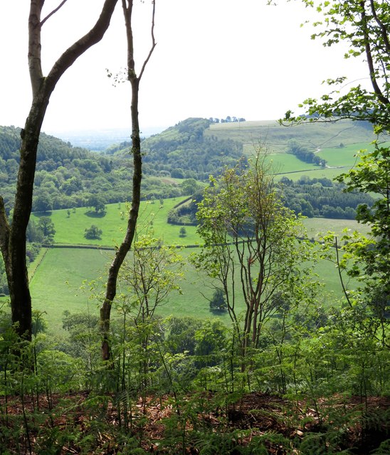
Image: © Gordon Hatton Taken: 19 Jun 2019
Cowesby Hall is hidden down below, but the view from the hill extends south towards the prominent gap through which runs the Cowesby to Kirby Knowle road, this gap being created, or overdeepened by glacial meltwaters some 17000 years ago. To the right is the outlying hill which bears no name on OS maps, but is generally known as Woolmoor locally after a farm which once stood on its summit plateau.
Images are licensed for reuse under creativecommons.org/licenses/by-sa/2.0
Image Location

Latitude
54.304674
Longitude
-1.273225