
IMAGES TAKEN NEAR TO
Elmslac Road, YORK, YO62 5AW
Introduction
This page details the photographs taken nearby to Elmslac Road, YO62 5AW by members of the Geograph project.
The Geograph project started in 2005 with the aim of publishing, organising and preserving representative images for every square kilometre of Great Britain, Ireland and the Isle of Man.

There are currently over 7.5m images from over14,400 individuals and you can help contribute to the project by visiting https://www.geograph.org.uk
Image Map
Images are licensed for reuse under creativecommons.org/licenses/by-sa/2.0
Notes
- Clicking on the map will re-center to the selected point.
- The higher the marker number, the further away the image location is from the centre of the postcode.
Image Listing (242 Images Found)
Images are licensed for reuse under creativecommons.org/licenses/by-sa/2.0
Image
Details
Distance

4
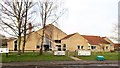
Helmsley primary school
A pleasant looking building using local materials. I'm unsure when it was built, but circa 1980 seems about right. The school replaced a much older building to the west of the High Street.
Image: © Gordon Hatton
Taken: 5 Jan 2018
0.10 miles
5

John Atkinson Memorial Trust playing fields, Helmsley
Image: © JThomas
Taken: 3 May 2025
0.10 miles

7
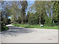
Baxtons Road
Leading to Baxtons Sprunt. The wooded area to the right encloses the cemetery.
Image: © Pauline E
Taken: 7 Apr 2011
0.11 miles
8

John Atkinson Memorial Trust playing fields, Helmsley
Image: © JThomas
Taken: 3 May 2025
0.12 miles
9
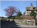
Stone Garth
Cul de sac of houses off Canons Garth Lane.
Image: © Pauline E
Taken: 7 Apr 2011
0.14 miles
10

Market Cross, Helmsley Marketplace
Image: © Maigheach-gheal
Taken: 12 Jul 2007
0.14 miles