
IMAGES TAKEN NEAR TO
Port Royal, YORK, YO43 4DX
Introduction
This page details the photographs taken nearby to Port Royal, YO43 4DX by members of the Geograph project.
The Geograph project started in 2005 with the aim of publishing, organising and preserving representative images for every square kilometre of Great Britain, Ireland and the Isle of Man.

There are currently over 7.5m images from over14,400 individuals and you can help contribute to the project by visiting https://www.geograph.org.uk
Image Map
Images are licensed for reuse under creativecommons.org/licenses/by-sa/2.0
Notes
- Clicking on the map will re-center to the selected point.
- The higher the marker number, the further away the image location is from the centre of the postcode.
Image Listing (26 Images Found)
Images are licensed for reuse under creativecommons.org/licenses/by-sa/2.0
Image
Details
Distance
1

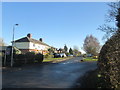
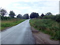
Port Royal
Looking along Port Royal which leads to Skiff Lane and Lock Lane.
Image: © DS Pugh
Taken: 30 Apr 2022
0.04 miles
4
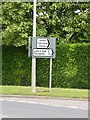
Turn here for rest area
Motorists on the busy A614 might consider turning off here if in need of 'forty winks' before continuing their journey. Signpost to one of the oddest places in England.
Image: © Gordon Hatton
Taken: 28 May 2009
0.08 miles
5

Gas marker pipe on Lock Lane
Lock Lane runs between Holme on Spalding Moor and the Land of Nod.
Image: © DS Pugh
Taken: 9 Mar 2025
0.08 miles
6
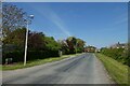
End of Skiff Lane
Looking towards the junction with Port Royal.
Image: © DS Pugh
Taken: 30 Apr 2022
0.08 miles
7

Denness' Farm Skiff Lane
A very old farmhouse
Image: © Charles Rispin
Taken: Unknown
0.08 miles
8
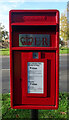
Elizabeth II postbox on Moor End, Holme upon Spalding Moor
Image: © JThomas
Taken: 18 Nov 2021
0.09 miles
9
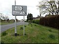
Moor End, Holme-upon-Spalding Moor
This is approaching Holme-upon-Spalding Moor from the south along the A614. The Land of Nod in East Yorkshire is a sleepy hamlet which would be practically unknown were it not for this road sign two miles away on the main road. It has a farm, a house and an architecture business and that is it. When you get to The Land of Nod the place is bleak to put it mildly - see www.geograph.org.uk/photo/7765254
Image: © Marathon
Taken: 20 Apr 2024
0.10 miles
10
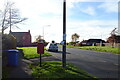
Moor End (A614), Holme upon Spalding Moor
Showing position of Postbox No. YO43 53.
See Image] for postbox.
Image: © JThomas
Taken: 18 Nov 2021
0.10 miles