Moor End, Holme-upon-Spalding Moor
Introduction
The photograph on this page of Moor End, Holme-upon-Spalding Moor by Marathon as part of the Geograph project.
The Geograph project started in 2005 with the aim of publishing, organising and preserving representative images for every square kilometre of Great Britain, Ireland and the Isle of Man.

There are currently over 7.5m images from over 14,400 individuals and you can help contribute to the project by visiting https://www.geograph.org.uk
Moor End, Holme-upon-Spalding Moor
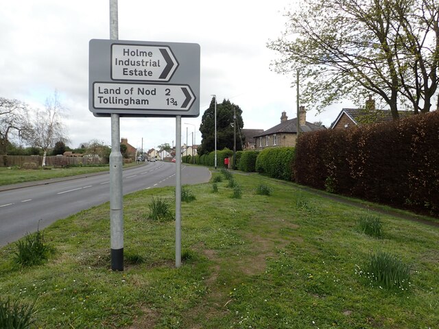
Image: © Marathon Taken: 20 Apr 2024
This is approaching Holme-upon-Spalding Moor from the south along the A614. The Land of Nod in East Yorkshire is a sleepy hamlet which would be practically unknown were it not for this road sign two miles away on the main road. It has a farm, a house and an architecture business and that is it. When you get to The Land of Nod the place is bleak to put it mildly - see www.geograph.org.uk/photo/7765254
Images are licensed for reuse under creativecommons.org/licenses/by-sa/2.0
Image Location
Latitude
53.829121
Longitude
-0.765956