IMAGES TAKEN NEAR TO
Holme Road, YORK, YO43 3PZ
Introduction
This page details the photographs taken nearby to Holme Road, YO43 3PZ by members of the Geograph project.
The Geograph project started in 2005 with the aim of publishing, organising and preserving representative images for every square kilometre of Great Britain, Ireland and the Isle of Man.

There are currently over 7.5m images from over14,400 individuals and you can help contribute to the project by visiting https://www.geograph.org.uk
Image Map (Loading...)


Getting Data...Please wait
Leaflet Map data © OpenStreetMap
Images are licensed for reuse under creativecommons.org/licenses/by-sa/2.0
Notes
- Clicking on the map will re-center to the selected point.
- The higher the marker number, the further away the image location is from the centre of the postcode.
Image Listing (4 Images Found)
Images are licensed for reuse under creativecommons.org/licenses/by-sa/2.0
Image
Details
Distance
1
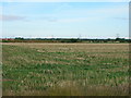
Flat fields and Grange Farm, Shipton Common
Image: © Jonathan Thacker
Taken: 6 Apr 2018
0.02 miles
2
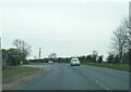
A614 Shipton Common
The A614 slices across East Yorkshire from Snaith in the west to Bridlington in the east
Image: © David Brown
Taken: 21 Apr 2022
0.11 miles