
IMAGES TAKEN NEAR TO
Hockling Close, YORK, YO42 2TN
Introduction
This page details the photographs taken nearby to Hockling Close, YO42 2TN by members of the Geograph project.
The Geograph project started in 2005 with the aim of publishing, organising and preserving representative images for every square kilometre of Great Britain, Ireland and the Isle of Man.

There are currently over 7.5m images from over14,400 individuals and you can help contribute to the project by visiting https://www.geograph.org.uk
Image Map
Images are licensed for reuse under creativecommons.org/licenses/by-sa/2.0
Notes
- Clicking on the map will re-center to the selected point.
- The higher the marker number, the further away the image location is from the centre of the postcode.
Image Listing (22 Images Found)
Images are licensed for reuse under creativecommons.org/licenses/by-sa/2.0
Image
Details
Distance
1

New housing along The Balk
One of a number of housing developments along the B1247.
Image: © DS Pugh
Taken: 9 Mar 2025
0.06 miles
2
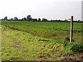
Footpath near Duck Belt
This is a short footpath which leads to the B1247 (Pocklington to Market Weighton Road). This picture and its foreground are within the allotted square.
Image: © Andy Beecroft
Taken: 11 Sep 2006
0.09 miles
3

Cycle path along the B1247
The cycle path runs between the two new housing developments (Wolds View and Stewarts Reach) into Pocklington.
Image: © DS Pugh
Taken: 9 Mar 2025
0.09 miles
4
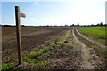
Footpath to the B1247
Running from Burnby Lane.
Image: © DS Pugh
Taken: 29 Sep 2013
0.11 miles
6
Property development continues on the edge of Pocklington
Image: © David Brown
Taken: 26 Jul 2021
0.14 miles
7

Stewarts Reach
The B1247 between York Road and Pocklington with a new housing development under construction.
Image: © DS Pugh
Taken: 9 Mar 2025
0.14 miles
9
Burnby Gatehouse
Heading along Burnby Lane.
Image: © DS Pugh
Taken: 29 Sep 2013
0.15 miles
10

The western end of Duck Belt
Duck Belt is a narrow strip of woodland alongside the Pocklington to Burnby road.
Image: © Jonathan Thacker
Taken: 14 Apr 2018
0.16 miles