IMAGES TAKEN NEAR TO
The Balk, YORK, YO42 2QQ
Introduction
This page details the photographs taken nearby to The Balk, YO42 2QQ by members of the Geograph project.
The Geograph project started in 2005 with the aim of publishing, organising and preserving representative images for every square kilometre of Great Britain, Ireland and the Isle of Man.

There are currently over 7.5m images from over14,400 individuals and you can help contribute to the project by visiting https://www.geograph.org.uk
Image Map
Images are licensed for reuse under creativecommons.org/licenses/by-sa/2.0
Notes
- Clicking on the map will re-center to the selected point.
- The higher the marker number, the further away the image location is from the centre of the postcode.
Image Listing (216 Images Found)
Images are licensed for reuse under creativecommons.org/licenses/by-sa/2.0
Image
Details
Distance
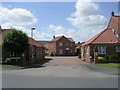
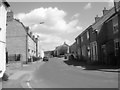
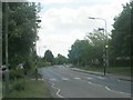
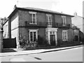
4
Station Road - viewed from The Balk
Image: © Betty Longbottom
Taken: 24 May 2011
0.03 miles
5
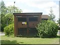
Electricity Substation No 4275 - The Balk
Image: © Betty Longbottom
Taken: 24 May 2011
0.04 miles
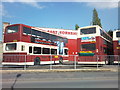
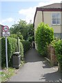
8
The Balk, Pocklington
Seen from the grassed reservation opposite Sainsbury's
Image: © Paul Harrop
Taken: 4 Nov 2009
0.05 miles
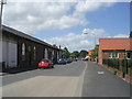
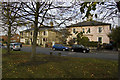
10
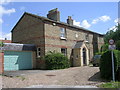
Wilson Memorial Hospital - The Balk
Built 1880.
Image: © Betty Longbottom
Taken: 24 May 2011
0.07 miles