IMAGES TAKEN NEAR TO
Burnby Lane, YORK, YO42 1UL
Introduction
This page details the photographs taken nearby to Burnby Lane, YO42 1UL by members of the Geograph project.
The Geograph project started in 2005 with the aim of publishing, organising and preserving representative images for every square kilometre of Great Britain, Ireland and the Isle of Man.

There are currently over 7.5m images from over14,400 individuals and you can help contribute to the project by visiting https://www.geograph.org.uk
Image Map (Loading...)


Getting Data...Please wait
Leaflet Map data © OpenStreetMap
Images are licensed for reuse under creativecommons.org/licenses/by-sa/2.0
Notes
- Clicking on the map will re-center to the selected point.
- The higher the marker number, the further away the image location is from the centre of the postcode.
Image Listing (7 Images Found)
Images are licensed for reuse under creativecommons.org/licenses/by-sa/2.0
Image
Details
Distance
2
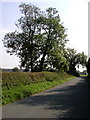
Throstle Nest Farm entrance near Burnby
Looking across Burnby Lane along the private road to the farm
Image: © Paul Harrop
Taken: 4 Nov 2009
0.11 miles
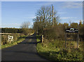
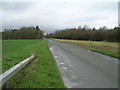
4
View from the Pocklington to Burnby road.
Looking NE towards the Yorkshire Wolds. In the field in the foreground was the Hull to York Railway closed in 1965. There are plans to re-open it soon!
Image: © Andy Beecroft
Taken: 11 Sep 2006
0.15 miles
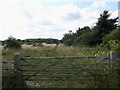
7

The Burnby to Pocklington road
Typical scene for the area.
Image: © Andy Beecroft
Taken: 11 Sep 2006
0.23 miles