IMAGES TAKEN NEAR TO
Chestnut Way, YORK, YO41 5SD
Introduction
This page details the photographs taken nearby to Chestnut Way, YO41 5SD by members of the Geograph project.
The Geograph project started in 2005 with the aim of publishing, organising and preserving representative images for every square kilometre of Great Britain, Ireland and the Isle of Man.

There are currently over 7.5m images from over14,400 individuals and you can help contribute to the project by visiting https://www.geograph.org.uk
Image Map (Loading...)


Getting Data...Please wait
Leaflet Map data © OpenStreetMap
Images are licensed for reuse under creativecommons.org/licenses/by-sa/2.0
Notes
- Clicking on the map will re-center to the selected point.
- The higher the marker number, the further away the image location is from the centre of the postcode.
Image Listing (26 Images Found)
Images are licensed for reuse under creativecommons.org/licenses/by-sa/2.0
Image
Details
Distance
1

Fangfoss
The village of Fangfoss, East Yorkshire.
Image: © DS Pugh
Taken: 30 Jul 2006
0.06 miles
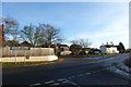
2

Houses in Fangfoss
Looking along a street in the village from the junction with Highfield Lane.
Image: © DS Pugh
Taken: 26 Nov 2022
0.08 miles
5
Fangfoss
Looking towards the Carpenters Arms.
Image: © DS Pugh
Taken: 1 Dec 2013
0.10 miles
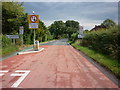
6
Carpenters Arms
Looking along Highfield Lane in Fangfoss.
Image: © DS Pugh
Taken: 26 Nov 2022
0.13 miles
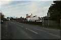
7

The Carpenters Arms, Fangfoss
Attractive village pub set by a busy country road linking Pocklington with Malton/Norton.
Image: © Gordon Hatton
Taken: 16 Mar 2009
0.14 miles

9
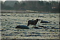
Sheep in field to Southeast of Back Lane Fangfoss
Image: © Nigel Glew
Taken: 19 Feb 2006
0.15 miles
