IMAGES TAKEN NEAR TO
Storking Lane, YORK, YO41 5QA
Introduction
This page details the photographs taken nearby to Storking Lane, YO41 5QA by members of the Geograph project.
The Geograph project started in 2005 with the aim of publishing, organising and preserving representative images for every square kilometre of Great Britain, Ireland and the Isle of Man.

There are currently over 7.5m images from over14,400 individuals and you can help contribute to the project by visiting https://www.geograph.org.uk
Image Map (Loading...)


Getting Data...Please wait
Leaflet Map data © OpenStreetMap
Images are licensed for reuse under creativecommons.org/licenses/by-sa/2.0
Notes
- Clicking on the map will re-center to the selected point.
- The higher the marker number, the further away the image location is from the centre of the postcode.
Image Listing (47 Images Found)
Images are licensed for reuse under creativecommons.org/licenses/by-sa/2.0
Image
Details
Distance
1
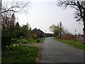
Outskirts of Wilberfoss
Several houses situated on the edge of Wilberfoss.
Image: © DS Pugh
Taken: 12 Apr 2007
0.02 miles
2
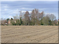
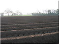
The Corn Is Sown
Facing North towards Ling Lane The field in Birker Lane that had pigs for years is now sown with corn. The houses in the background are on Ling Lane near to where Storking Lane becomes Ling Lane.
Image: © Keith Laverack
Taken: 19 Mar 2008
0.04 miles
3
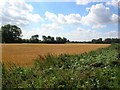
Towards Wilberfoss
Looking back towards Wilberfoss from along Ling Lane.
Image: © DS Pugh
Taken: 30 Jul 2006
0.09 miles
4
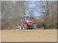
Drilling Corn
Where the pigs were down Birker Lane has now been cultivated and this photo shows the land being drilled with corn. In the background are houses in Ling Lane. These houses are near to where Storking Lane becomes Ling Lane. The photo was taken facing North North West from Birker Lane.
Image: © Keith Laverack
Taken: 19 Mar 2008
0.12 miles
5
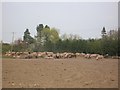
Pigs in dust
On the edge of Wilberfoss there is a pig farm, here the pigs are kicking up a lot of dust in the very dry spring.
Image: © DS Pugh
Taken: 12 Apr 2007
0.13 miles
7
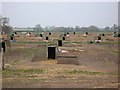
Pig Farm
On a road to nowhere from Wilberfoss. The road heads to Foss Farm before giving way to fields.
Image: © DS Pugh
Taken: 12 Apr 2007
0.16 miles
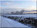
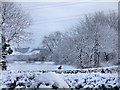
8

Wilberfoss Winter
Fir trees Birker Lane Wilberfoss
Image: © Keith Laverack
Taken: 19 Dec 2009
0.17 miles
9
2010 Wilberfoss Birker Lane Field Head Junction
This is taken from the exact spot where Image was taken.
Image: © Keith Laverack
Taken: 2 Jan 2010
0.17 miles
10
Wilberfoss to Yorkshire Wolds
This is taken from Field Head Wilberfoss looking towards Birker Lane (where the person is seen walking). The Yorkshire Wolds can be seen in the distance. These appear to be across the A166 towards Kirby Underdale. See Image
Image: © Keith Laverack
Taken: 2 Jan 2010
0.17 miles