IMAGES TAKEN NEAR TO
Sutton On Derwent, YORK, YO41 4DF
Introduction
This page details the photographs taken nearby to YO41 4DF by members of the Geograph project.
The Geograph project started in 2005 with the aim of publishing, organising and preserving representative images for every square kilometre of Great Britain, Ireland and the Isle of Man.

There are currently over 7.5m images from over14,400 individuals and you can help contribute to the project by visiting https://www.geograph.org.uk
Image Map (Loading...)


Getting Data...Please wait
Leaflet Map data © OpenStreetMap
Images are licensed for reuse under creativecommons.org/licenses/by-sa/2.0
Notes
- Clicking on the map will re-center to the selected point.
- The higher the marker number, the further away the image location is from the centre of the postcode.
Image Listing (15 Images Found)
Images are licensed for reuse under creativecommons.org/licenses/by-sa/2.0
Image
Details
Distance
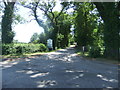

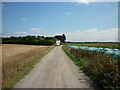
3
Woodhouse Grange
Looking along the road to Sutton.
Image: © DS Pugh
Taken: 25 May 2009
0.08 miles
4
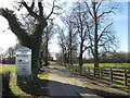
Entrance to Woodhouse Grange Business Centre
Image: © John Slater
Taken: 25 Mar 2018
0.08 miles
5
A walk from Wilberfoss #43
Looking back towards Woodhouse Grange Farm.
Image: © Ian S
Taken: 9 Aug 2010
0.09 miles

7
A walk from Wilberfoss #40
Walking towards Woodhouse Grange.
Image: © Ian S
Taken: 9 Aug 2010
0.10 miles
8
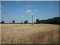
A walk from Wilberfoss #41
Looking North from track.
Image: © Ian S
Taken: 9 Aug 2010
0.11 miles
9
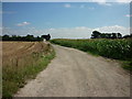
A walk from Wilberfoss #37
The track to Woodhouse Grange.
Image: © Ian S
Taken: 9 Aug 2010
0.11 miles
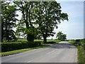
10
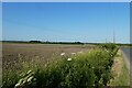
Fields beside Sandhill Lane
Sandhill Lane near Woodhouse Grange.
Image: © DS Pugh
Taken: 13 Jun 2023
0.12 miles