IMAGES TAKEN NEAR TO
Painsthorpe, YORK, YO41 1RQ
Introduction
This page details the photographs taken nearby to Painsthorpe, YO41 1RQ by members of the Geograph project.
The Geograph project started in 2005 with the aim of publishing, organising and preserving representative images for every square kilometre of Great Britain, Ireland and the Isle of Man.

There are currently over 7.5m images from over14,400 individuals and you can help contribute to the project by visiting https://www.geograph.org.uk
Image Map
Images are licensed for reuse under creativecommons.org/licenses/by-sa/2.0
Notes
- Clicking on the map will re-center to the selected point.
- The higher the marker number, the further away the image location is from the centre of the postcode.
Image Listing (9 Images Found)
Images are licensed for reuse under creativecommons.org/licenses/by-sa/2.0
Image
Details
Distance
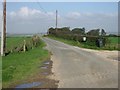
1
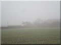
Painsthorpe Wold Farm in the mist
At over 200 metres above sea level mist is not infrequent here.
Image: © Jonathan Thacker
Taken: 22 Nov 2014
0.02 miles
2
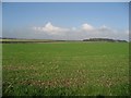
Cloudscape, Field and Wood
Looking over Uncleby Wold.
Image: © Roger Gilbertson
Taken: 13 Oct 2006
0.15 miles
3
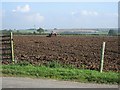
Harrowing
A tractor working close to Breckenholme Farm.
Image: © Roger Gilbertson
Taken: 13 Oct 2006
0.15 miles
4
A Harrowing Site
The tractor harrowing a field near Breckenholme can be seen at the far end of the field.
Image: © Roger Gilbertson
Taken: 13 Oct 2006
0.15 miles
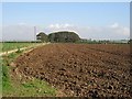
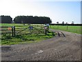
5
The Road To Breckenholme Farm
From the former Roman road across Uncleby Wold.
Image: © Roger Gilbertson
Taken: 13 Oct 2006
0.15 miles
6
The Track To Painsthorpe Wold Farm
Close to the former Roman road.
Image: © Roger Gilbertson
Taken: 13 Oct 2006
0.15 miles
7
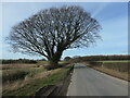
Hedgerow tree, Roman Road
Looking north near Uncleby Brow.
Image: © Christine Johnstone
Taken: 17 Feb 2023
0.22 miles
8
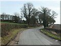
A bend in the Roman Road
Near Painsthorpe Wold Cottage.
Image: © Christine Johnstone
Taken: 17 Feb 2023
0.22 miles
