IMAGES TAKEN NEAR TO
The Airfield, YORK, YO41 1HS
Introduction
This page details the photographs taken nearby to The Airfield, YO41 1HS by members of the Geograph project.
The Geograph project started in 2005 with the aim of publishing, organising and preserving representative images for every square kilometre of Great Britain, Ireland and the Isle of Man.

There are currently over 7.5m images from over14,400 individuals and you can help contribute to the project by visiting https://www.geograph.org.uk
Image Map (Loading...)


Getting Data...Please wait
Leaflet Map data © OpenStreetMap
Images are licensed for reuse under creativecommons.org/licenses/by-sa/2.0
Notes
- Clicking on the map will re-center to the selected point.
- The higher the marker number, the further away the image location is from the centre of the postcode.
Image Listing (17 Images Found)
Images are licensed for reuse under creativecommons.org/licenses/by-sa/2.0
Image
Details
Distance
1
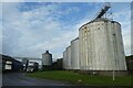
Grain silos on the industrial estate
On the Full Sutton Industrial Estate constructed on the former airfield.
Image: © DS Pugh
Taken: 26 Nov 2022
0.04 miles
2
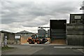
Grain storage on Full Sutton Industrial Estate
Image: © Chris
Taken: 9 Aug 2015
0.05 miles
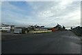
3
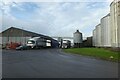
Full Sutton Industrial Estate
Full Sutton Industrial Estate is constructed on the former airfield.
Image: © DS Pugh
Taken: 26 Nov 2022
0.05 miles
4
Sam's Van
The opening times would suggest that it should be open.
Image: © DS Pugh
Taken: 26 Nov 2022
0.08 miles
6
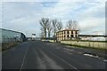
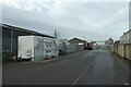
North Avenue
Looking along North Avenue on the Full Sutton Industrial Estate constructed on the former airfield.
Image: © DS Pugh
Taken: 26 Nov 2022
0.11 miles
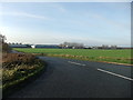
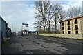
7
Industrial estate on the airfield
The Full Sutton Industrial Estate constructed on the former airfield.
Image: © DS Pugh
Taken: 26 Nov 2022
0.12 miles
8
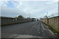
Southern avenue on the industrial estate
The Full Sutton Industrial Estate is constructed on the former airfield.
Image: © DS Pugh
Taken: 26 Nov 2022
0.12 miles
9
East Riding Sacks
On the Full Sutton Industrial Estate constructed on the former airfield.
Image: © DS Pugh
Taken: 26 Nov 2022
0.14 miles
10
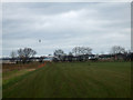
Helicopter Above Full Sutton Airfield
The airfield shown as disused on the map is actually active with light aircraft using it every day. The Buildings are Industrial estate buildings on the edge of the runway
Image: © Keith Laverack
Taken: 22 Feb 2008
0.16 miles