
IMAGES TAKEN NEAR TO
Woodhouse Close, YORK, YO41 1FW
Introduction
This page details the photographs taken nearby to Woodhouse Close, YO41 1FW by members of the Geograph project.
The Geograph project started in 2005 with the aim of publishing, organising and preserving representative images for every square kilometre of Great Britain, Ireland and the Isle of Man.

There are currently over 7.5m images from over14,400 individuals and you can help contribute to the project by visiting https://www.geograph.org.uk
Image Map
Images are licensed for reuse under creativecommons.org/licenses/by-sa/2.0
Notes
- Clicking on the map will re-center to the selected point.
- The higher the marker number, the further away the image location is from the centre of the postcode.
Image Listing (86 Images Found)
Images are licensed for reuse under creativecommons.org/licenses/by-sa/2.0
Image
Details
Distance
1
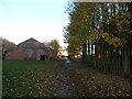
Stamford Bridge station
No longer in use, the York to Beverley line was closed in 1965, though passenger services closed earlier in 1959. The station platforms and sheds are still clearly visible. This section is now a cycle path and footpath.
Image: © DS Pugh
Taken: 26 Nov 2006
0.06 miles
2
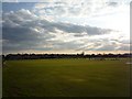
Stamford Bridge Cricket Club
A match is underway on a late spring evening in Stamford Bridge.
Image: © DS Pugh
Taken: 22 Apr 2010
0.07 miles
3
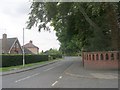
Low Catton Road - viewed from Church Road
Image: © Betty Longbottom
Taken: 30 Jul 2011
0.10 miles
4
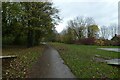
Path from Stamford Bridge Station
Looking along the path near the ends of the platforms and looking towards the viaduct over the River Derwent.
Image: © DS Pugh
Taken: 14 Nov 2020
0.10 miles
5
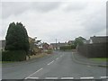
Roman Avenue North - High Catton Road
Image: © Betty Longbottom
Taken: 30 Jul 2011
0.10 miles
6
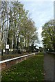
Stamford Bridge down platform
Looking along the Hull bound platform of the former railway station. For more info see: http://disused-stations.org.uk/s/stamford_bridge/index.shtml and https://en.wikipedia.org/wiki/Stamford_Bridge_railway_station
Image: © DS Pugh
Taken: 26 Nov 2022
0.11 miles
7
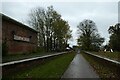
Stamford Bridge railway station
Looking along the platforms of the long closed railway station. Part of the trackbed is now a cycle path.
Image: © DS Pugh
Taken: 14 Nov 2020
0.11 miles
8
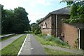
Platform and goods shed
The former platform for trains towards Beverley at Stamford Bridge.
Image: © DS Pugh
Taken: 28 May 2023
0.11 miles
9
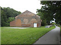
Former railway station, Stamford Bridge
For a closer look see Image The station was opened in for the York and North Midland Railway Company. Rail services ceased in 1965 and the line is now part of the Transpennine Trail and Way of the Roses route. The buildings and platforms are now listed grade 2 (list entry 1083842).
Image: © Stephen Craven
Taken: 7 Jul 2017
0.11 miles
10
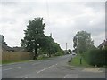
High Catton Road - viewed from Church Road
Image: © Betty Longbottom
Taken: 30 Jul 2011
0.11 miles