
IMAGES TAKEN NEAR TO
Foss Islands Road, YORK, YO31 7UY
Introduction
This page details the photographs taken nearby to Foss Islands Road, YO31 7UY by members of the Geograph project.
The Geograph project started in 2005 with the aim of publishing, organising and preserving representative images for every square kilometre of Great Britain, Ireland and the Isle of Man.

There are currently over 7.5m images from over14,400 individuals and you can help contribute to the project by visiting https://www.geograph.org.uk
Image Map
Images are licensed for reuse under creativecommons.org/licenses/by-sa/2.0
Notes
- Clicking on the map will re-center to the selected point.
- The higher the marker number, the further away the image location is from the centre of the postcode.
Image Listing (451 Images Found)
Images are licensed for reuse under creativecommons.org/licenses/by-sa/2.0
Image
Details
Distance
1

Navigation Road and evidence of the water levels
This area of York was extensively flooded following the Boxing Day rainfall and subsequent river level rises. Normally this area wouldn't flood as it is protected by the Foss Barrier, which failed this time. Note the level the water reached on the wall.
Image: © DS Pugh
Taken: 1 Jan 2016
0.01 miles
2
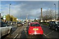
Foss Islands Road
Looking towards the junction for Foss Islands Retail Park.
Image: © DS Pugh
Taken: 3 Dec 2022
0.02 miles
3
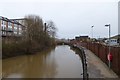
Towards Foss Islands
Looking along the River Foss towards Foss Islands Road.
Image: © DS Pugh
Taken: 1 Jan 2016
0.03 miles
4
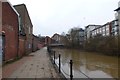
Foss Path
Looking along the path running along the River Foss from Foss Islands Road.
Image: © DS Pugh
Taken: 1 Jan 2016
0.03 miles
5
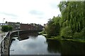
Along the Foss
Looking along the River Foss from Foss Islands Road.
Image: © DS Pugh
Taken: 2 Jul 2021
0.03 miles
6
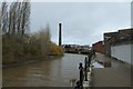
Foss Navigation
Looking along the River Foss near Foss Islands.
Image: © DS Pugh
Taken: 22 Feb 2020
0.03 miles
7

'The Destructor' chimney
Now known as 'Morrison's Chimney' it is all that remains of York's joint refuse incinerator and power station. Seen in 2006, when the disused buildings were still intact. The elegant chimney was erected in 1899 and was known as 'The Destructor'.
Image: © Philip Pankhurst
Taken: 25 Apr 2006
0.04 miles
8
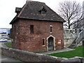
The brick built: Red Tower
The northern portion of the wall ends at the Red Tower, built in 1490, to replace an earlier stone postern, at the edge of the Kings Fishpond.
Image: © Matthew Hatton
Taken: 3 Feb 2007
0.04 miles
9
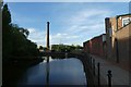
River Foss near Navigation Road
Looking towards the chimney next to Morrisons.
Image: © DS Pugh
Taken: 25 May 2020
0.04 miles
10
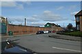
Navigation Road
Looking along Navigation Road towards Foss Islands Road.
Image: © DS Pugh
Taken: 19 Mar 2023
0.04 miles