
IMAGES TAKEN NEAR TO
Station Road, YORK, YO26 8DX
Introduction
This page details the photographs taken nearby to Station Road, YO26 8DX by members of the Geograph project.
The Geograph project started in 2005 with the aim of publishing, organising and preserving representative images for every square kilometre of Great Britain, Ireland and the Isle of Man.

There are currently over 7.5m images from over14,400 individuals and you can help contribute to the project by visiting https://www.geograph.org.uk
Image Map
Images are licensed for reuse under creativecommons.org/licenses/by-sa/2.0
Notes
- Clicking on the map will re-center to the selected point.
- The higher the marker number, the further away the image location is from the centre of the postcode.
Image Listing (52 Images Found)
Images are licensed for reuse under creativecommons.org/licenses/by-sa/2.0
Image
Details
Distance
1
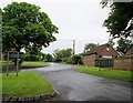
Looking up Cattal Street from Chapel Street
This photo is on the line of the Roman Road called Rudgate, which runs from Headley Bar Tadcaster to Whixley.
Image: © Martin Dawes
Taken: 9 Jul 2016
0.01 miles
2
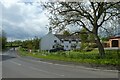
Cottages and bunting in Cattal
The village of Cattal with bunting for the coronation.
Image: © DS Pugh
Taken: 7 May 2023
0.03 miles
4
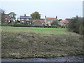
Cattal Village
Seen across the River Nidd. The village is a small collection of houses at the river crossing.
Image: © Alan Murray-Rust
Taken: 12 Nov 2009
0.07 miles
5
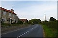
Ox Moor Lane
Houses in Cattal along Ox Moor Lane.
Image: © DS Pugh
Taken: 8 Aug 2015
0.08 miles
7

Manor House, Cattal
The house dates from the late 18th century and is Listed Grade II. The lean-to to the right was originally a byre, and the extension to the left a smithy. The name ‘Manor House’ was apparently only given around 1950 and does not indicate any manorial status.
Image: © Alan Murray-Rust
Taken: 28 Oct 2025
0.09 miles
8

Manor House, Cattal
Viewed from the bridge. The house dates from the late 18th century and is Listed Grade II.
Image: © Alan Murray-Rust
Taken: 28 Oct 2025
0.09 miles
10

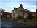
View from Cattal bridge
Looking downstream along the River Nidd from Cattal Bridge. The Nidd is quite narrow at this point [compare with Knaresborough several miles upstream] and is contained between high banks. With water levels low during a period of freezing weather it is difficult to imagine the river in flood when it overtops these banks.
Image: © Gordon Hatton
Taken: 8 Dec 2010
0.09 miles