IMAGES TAKEN NEAR TO
Aldermans Way, DRIFFIELD, YO25 8SG
Introduction
This page details the photographs taken nearby to Aldermans Way, YO25 8SG by members of the Geograph project.
The Geograph project started in 2005 with the aim of publishing, organising and preserving representative images for every square kilometre of Great Britain, Ireland and the Isle of Man.

There are currently over 7.5m images from over14,400 individuals and you can help contribute to the project by visiting https://www.geograph.org.uk
Image Map
Images are licensed for reuse under creativecommons.org/licenses/by-sa/2.0
Notes
- Clicking on the map will re-center to the selected point.
- The higher the marker number, the further away the image location is from the centre of the postcode.
Image Listing (217 Images Found)
Images are licensed for reuse under creativecommons.org/licenses/by-sa/2.0
Image
Details
Distance
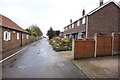
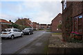
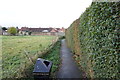
2
Aldermans Way off Boardman Park, Brandesburton
Image: © Ian S
Taken: 23 Nov 2016
0.02 miles
3
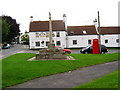
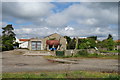
Black Swan - Cross Hill
This area is dotted with sand and gravel pits, some of which, now water filled are used for fishing and water sports.
Image: © Stephen Horncastle
Taken: 20 Aug 2005
0.03 miles
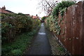
5
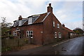
Wayside Cottage
On Boardman Lane, Brandesburton.
Image: © Ian S
Taken: 23 Nov 2016
0.04 miles
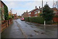
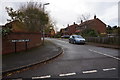
8
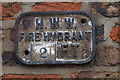
HWW Fire Hydrant Plate
On Boardman Lane, Brandesburton.
Image: © Ian S
Taken: 23 Nov 2016
0.05 miles