IMAGES TAKEN NEAR TO
The Meadows, DRIFFIELD, YO25 8QG
Introduction
This page details the photographs taken nearby to The Meadows, YO25 8QG by members of the Geograph project.
The Geograph project started in 2005 with the aim of publishing, organising and preserving representative images for every square kilometre of Great Britain, Ireland and the Isle of Man.

There are currently over 7.5m images from over14,400 individuals and you can help contribute to the project by visiting https://www.geograph.org.uk
Image Map (Loading...)


Getting Data...Please wait
Leaflet Map data © OpenStreetMap
Images are licensed for reuse under creativecommons.org/licenses/by-sa/2.0
Notes
- Clicking on the map will re-center to the selected point.
- The higher the marker number, the further away the image location is from the centre of the postcode.
Image Listing (201 Images Found)
Images are licensed for reuse under creativecommons.org/licenses/by-sa/2.0
Image
Details
Distance
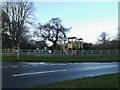
4
Entering Brandesburton on Frodingham Road
Image: © Martin Dawes
Taken: 18 Apr 2018
0.04 miles
8
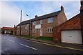
Houses at Corner Farm
On Main Street, Brandesburton.
Image: © Ian S
Taken: 23 Nov 2016
0.05 miles