IMAGES TAKEN NEAR TO
Skerne Road, DRIFFIELD, YO25 8NQ
Introduction
This page details the photographs taken nearby to Skerne Road, YO25 8NQ by members of the Geograph project.
The Geograph project started in 2005 with the aim of publishing, organising and preserving representative images for every square kilometre of Great Britain, Ireland and the Isle of Man.

There are currently over 7.5m images from over14,400 individuals and you can help contribute to the project by visiting https://www.geograph.org.uk
Image Map
Images are licensed for reuse under creativecommons.org/licenses/by-sa/2.0
Notes
- Clicking on the map will re-center to the selected point.
- The higher the marker number, the further away the image location is from the centre of the postcode.
Image Listing (44 Images Found)
Images are licensed for reuse under creativecommons.org/licenses/by-sa/2.0
Image
Details
Distance
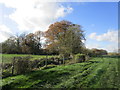
1
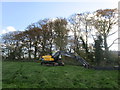
Saturday is my day-off
At rest after a few days clearing Main Drain of unwanted vegetation.
Image: © Jonathan Thacker
Taken: 1 Nov 2014
0.08 miles
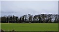
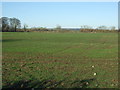
3
Access road to Golden Hill Farm
Having walked through the farm I am not sure where the hill is,the map has few contour lines.
Image: © Martin Dawes
Taken: 13 Jan 2016
0.08 miles

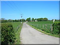
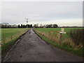
10
Minor road towards Skerne
Heading south west.
Image: © JThomas
Taken: 13 Dec 2014
0.17 miles