IMAGES TAKEN NEAR TO
Southfield Lane, DRIFFIELD, YO25 8FW
Introduction
This page details the photographs taken nearby to Southfield Lane, YO25 8FW by members of the Geograph project.
The Geograph project started in 2005 with the aim of publishing, organising and preserving representative images for every square kilometre of Great Britain, Ireland and the Isle of Man.

There are currently over 7.5m images from over14,400 individuals and you can help contribute to the project by visiting https://www.geograph.org.uk
Image Map
Images are licensed for reuse under creativecommons.org/licenses/by-sa/2.0
Notes
- Clicking on the map will re-center to the selected point.
- The higher the marker number, the further away the image location is from the centre of the postcode.
Image Listing (61 Images Found)
Images are licensed for reuse under creativecommons.org/licenses/by-sa/2.0
Image
Details
Distance
1
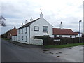
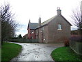
Southview Cottages, Barmston
Self catering holiday accommodation.
Image: © JThomas
Taken: 19 Dec 2015
0.01 miles
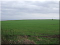
3
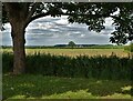
Agricultural landscape north of Barmston
Image: © Neil Theasby
Taken: 21 Jun 2022
0.04 miles
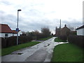
7
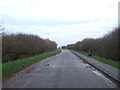
Sands Lane, Barmston
Heading east towards the sea.
Image: © JThomas
Taken: 19 Dec 2015
0.09 miles
9
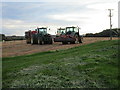
Waiting for the morning
A day's work done.
Image: © Jonathan Thacker
Taken: 13 Oct 2017
0.09 miles
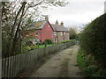
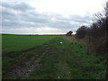
10
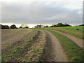
Southfield Lane
A farm track and public footpath.
Image: © Jonathan Thacker
Taken: 13 Oct 2017
0.10 miles