IMAGES TAKEN NEAR TO
Bewholme, DRIFFIELD, YO25 8ED
Introduction
This page details the photographs taken nearby to YO25 8ED by members of the Geograph project.
The Geograph project started in 2005 with the aim of publishing, organising and preserving representative images for every square kilometre of Great Britain, Ireland and the Isle of Man.

There are currently over 7.5m images from over14,400 individuals and you can help contribute to the project by visiting https://www.geograph.org.uk
Image Map
Images are licensed for reuse under creativecommons.org/licenses/by-sa/2.0
Notes
- Clicking on the map will re-center to the selected point.
- The higher the marker number, the further away the image location is from the centre of the postcode.
Image Listing (12 Images Found)
Images are licensed for reuse under creativecommons.org/licenses/by-sa/2.0
Image
Details
Distance
1
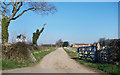
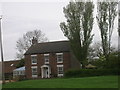
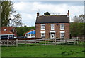
Bewholme House
Bewholme House is situated north of Bewholme. This grid square is mostly farmland.
Image: © Stephen Horncastle
Taken: 12 Nov 2005
0.06 miles
2
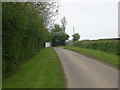
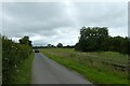
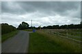
North End
Looking along North Road to the north of Bewholme.
Image: © DS Pugh
Taken: 13 Jul 2021
0.08 miles
3
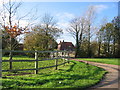
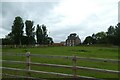
Car on North Road
Looking along the road towards Bewholme.
Image: © DS Pugh
Taken: 13 Jul 2021
0.12 miles
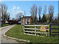
8
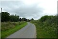
Road near Field House Farm
Looking along North Road near Bewholme.
Image: © DS Pugh
Taken: 13 Jul 2021
0.20 miles