
IMAGES TAKEN NEAR TO
Camellia Close, DRIFFIELD, YO25 6QT
Introduction
This page details the photographs taken nearby to Camellia Close, YO25 6QT by members of the Geograph project.
The Geograph project started in 2005 with the aim of publishing, organising and preserving representative images for every square kilometre of Great Britain, Ireland and the Isle of Man.

There are currently over 7.5m images from over14,400 individuals and you can help contribute to the project by visiting https://www.geograph.org.uk
Image Map
Images are licensed for reuse under creativecommons.org/licenses/by-sa/2.0
Notes
- Clicking on the map will re-center to the selected point.
- The higher the marker number, the further away the image location is from the centre of the postcode.
Image Listing (20 Images Found)
Images are licensed for reuse under creativecommons.org/licenses/by-sa/2.0
Image
Details
Distance
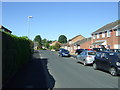
2
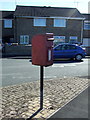
Elizabeth II postbox on Duncombe Drive, Driffield
Image: © JThomas
Taken: 6 Aug 2016
0.14 miles
3

Path beside Duncombe Drive, Driffield
Showing position of Postbox No. YO25 351.
See Image] for postbox.
Image: © JThomas
Taken: 6 Aug 2016
0.14 miles
4
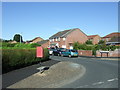
Duncombe Drive, Driffield
Showing position of Postbox No. YO25 351.
See Image] for postbox.
Image: © JThomas
Taken: 6 Aug 2016
0.14 miles
5
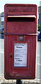
Close up, Elizabeth II postbox on Duncombe Drive, Driffield
Postbox No. YO25 351.
See Image] for wider view.
Image: © JThomas
Taken: 6 Aug 2016
0.15 miles
6
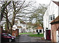
King's Mill, Driffield
Looking west-southwest from the end of King's Mill Road towards King's Mill House, with Keepers Cottage on the right. The mill itself apparently burned down in 1906.
Image: © Paul Glazzard
Taken: 26 Apr 2008
0.17 miles
7
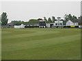
Scoreboard at Drffield Town Cricket Club
Image: © Peter Robinson
Taken: 5 May 2011
0.19 miles
9
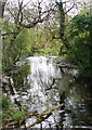
The Keld
The southeastern end of the millpond called The Keld behind Millers House at King's Mill, Driffield, viewed from the footbridge.
Image: © Paul Glazzard
Taken: 26 Apr 2008
0.20 miles
10
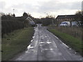
Church Lane, Little Driffield
This is where the Driffield to Malton Railway crossed this minor road up until its closure in the 50s. Taken at MR: TA01095723 looking SSE.
Image: © Andy Beecroft
Taken: 14 Feb 2006
0.22 miles