IMAGES TAKEN NEAR TO
Darley Close, DRIFFIELD, YO25 4UA
Introduction
This page details the photographs taken nearby to Darley Close, YO25 4UA by members of the Geograph project.
The Geograph project started in 2005 with the aim of publishing, organising and preserving representative images for every square kilometre of Great Britain, Ireland and the Isle of Man.

There are currently over 7.5m images from over14,400 individuals and you can help contribute to the project by visiting https://www.geograph.org.uk
Image Map
Images are licensed for reuse under creativecommons.org/licenses/by-sa/2.0
Notes
- Clicking on the map will re-center to the selected point.
- The higher the marker number, the further away the image location is from the centre of the postcode.
Image Listing (10 Images Found)
Images are licensed for reuse under creativecommons.org/licenses/by-sa/2.0
Image
Details
Distance
1
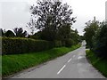
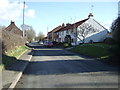
Berriman's Lane, Kilham
Taken from the junction with West End.
Image: © Christine Johnstone
Taken: 2 Oct 2010
0.05 miles
2
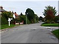
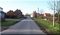
Village signpost
At the junction of West End and Berriman's Lane, Kilham.
Image: © Christine Johnstone
Taken: 2 Oct 2010
0.07 miles
3
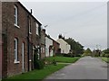
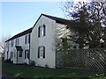
West End houses, Kilham
West of Berriman's Lane, near the end of the village.
Image: © Christine Johnstone
Taken: 2 Oct 2010
0.10 miles
6
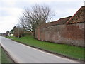
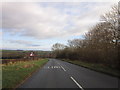
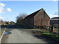
West End
Looking west along the road to Kilham.
Image: © Stephen Horncastle
Taken: 18 Mar 2006
0.14 miles