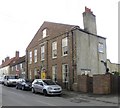
IMAGES TAKEN NEAR TO
Bakehouse Lane, DRIFFIELD, YO25 4TG

Introduction

This page details the photographs taken nearby to Bakehouse Lane, YO25 4TG by members of the Geograph project.

The Geograph project started in 2005 with the aim of publishing, organising and preserving representative images for every square kilometre of Great Britain, Ireland and the Isle of Man.

There are currently over 7.5m images from over14,400 individuals and you can help contribute to the project by visiting https://www.geograph.org.uk

Image Map


Images are licensed for reuse under creativecommons.org/licenses/by-sa/2.0
Notes
  • Clicking on the map will re-center to the selected point.
  • The higher the marker number, the further away the image location is from the centre of the postcode.

Image Listing (112 Images Found)

Images are licensed for reuse under creativecommons.org/licenses/by-sa/2.0
  • ...
Image
Details
Distance
1
The old market place, Kilham
The stone in the verge identifies this area as Kilham's medieval marketplace.
Image: © Christine Johnstone Taken: 2 Oct 2010
0.03 miles
2
Church Street, Kilham
The footpath sign is pointing to Bakehouse Lane, on the opposite side of the street.
Image: © Christine Johnstone Taken: 2 Oct 2010
0.03 miles
3
Hall Farm, Kilham
The most ambitious period house in the village would not look out of place in Beverley or Driffield. It is dated 1716 and has an impressive five bay front facing out on to East Street. The plain rendered side elevation looks slightly less grand.
Image: © Gordon Hatton Taken: 8 May 2011
0.03 miles
4
Cottages on Church Street, Kilham
Image: © JThomas Taken: 21 Feb 2015
0.03 miles
5
Kilham village water pump
Image: © Martin Dawes Taken: 10 Sep 2020
0.03 miles
6
General view of Kilham from SE
Taken from 1/4 mile west of Bracey Bridge showing village and post enclosure field boundaries.
Image: © John Phillips Taken: 28 Feb 2006
0.03 miles
7
The Saddlers, Kilham
The Saddlers is an attractive 18th century brick and pantile house at the corner of Bakehouse Lane and the old Market Place.
Image: © Gordon Hatton Taken: 8 May 2011
0.03 miles
8
East Street, Kilham
Kilham is a long straggle of eighteenth and nineteenth century cottages and farms.
Image: © Jonathan Thacker Taken: 5 Apr 2018
0.03 miles
9
Hall Farmhouse, East Street, Kilham
Dates from 1716 https://historicengland.org.uk/listing/the-list/list-entry/1083354 and is one of the grander buildings in the long straggle of eighteenth and nineteenth century cottages and farms which constitutes Kilham.
Image: © Jonathan Thacker Taken: 5 Apr 2018
0.04 miles
10
Kilham (E Yorks): East Street from the churchyard
Looking east from the grounds of All Saints Church
Image: © Paul Harrop Taken: 9 Jul 2015
0.04 miles
  • ...