IMAGES TAKEN NEAR TO
Pockthorpe, DRIFFIELD, YO25 4SY
Introduction
This page details the photographs taken nearby to Pockthorpe, YO25 4SY by members of the Geograph project.
The Geograph project started in 2005 with the aim of publishing, organising and preserving representative images for every square kilometre of Great Britain, Ireland and the Isle of Man.

There are currently over 7.5m images from over14,400 individuals and you can help contribute to the project by visiting https://www.geograph.org.uk
Image Map (Loading...)


Getting Data...Please wait
Leaflet Map data © OpenStreetMap
Images are licensed for reuse under creativecommons.org/licenses/by-sa/2.0
Notes
- Clicking on the map will re-center to the selected point.
- The higher the marker number, the further away the image location is from the centre of the postcode.
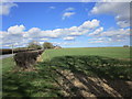
Image Listing (11 Images Found)
Images are licensed for reuse under creativecommons.org/licenses/by-sa/2.0
Image
Details
Distance
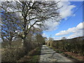
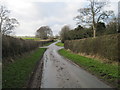
3
Pockthorpe Lane toward Ruston Parva
From in front of Pockthorpe Cottages
Image: © Martin Dawes
Taken: 30 Jan 2013
0.13 miles
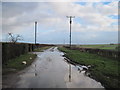
6
Lane to Pockthorpe Hall
The lane reduces to a track after the hall
Image: © Martin Dawes
Taken: 30 Jan 2013
0.14 miles
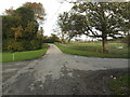
7
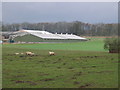
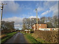
Farm Near North Plantation
View west from near the road junction.
Image: © Stephen Horncastle
Taken: 25 Mar 2006
0.15 miles