IMAGES TAKEN NEAR TO
Kilham, DRIFFIELD, YO25 4SB
Introduction
This page details the photographs taken nearby to YO25 4SB by members of the Geograph project.
The Geograph project started in 2005 with the aim of publishing, organising and preserving representative images for every square kilometre of Great Britain, Ireland and the Isle of Man.

There are currently over 7.5m images from over14,400 individuals and you can help contribute to the project by visiting https://www.geograph.org.uk
Image Map (Loading...)


Getting Data...Please wait
Leaflet Map data © OpenStreetMap
Images are licensed for reuse under creativecommons.org/licenses/by-sa/2.0
Notes
- Clicking on the map will re-center to the selected point.
- The higher the marker number, the further away the image location is from the centre of the postcode.
Image Listing (17 Images Found)
Images are licensed for reuse under creativecommons.org/licenses/by-sa/2.0
Image
Details
Distance
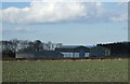
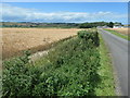
3
Tuft Hill Farm
View north from the Kilham road.
Image: © Stephen Horncastle
Taken: 25 Mar 2006
0.04 miles
5
Yorkshire Wolds crops at Tuft Hill Farm
Barley and electricity.
Image: © Christine Johnstone
Taken: 6 Jul 2020
0.15 miles
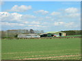
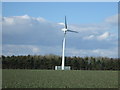
6
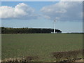
Crop field and wind turbine, Tuft Hill Farm
Off Woldgate Roman Road.
Image: © JThomas
Taken: 21 Feb 2015
0.16 miles
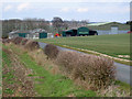
7
Entrance to Tuft Hill Farm
On the north side of Woldgate, east of Kilham.
Image: © Christine Johnstone
Taken: 6 Jul 2020
0.16 miles
8
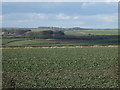
Crop field near Tuft Hill Farm
Off Woldgate Roman Road.
Image: © JThomas
Taken: 21 Feb 2015
0.18 miles
9
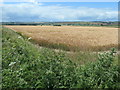
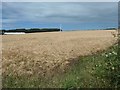
Barley field, Tuft Hill Farm
A lot of cereals are grown on the chalky Yorkshire Wolds.
Image: © Christine Johnstone
Taken: 6 Jul 2020
0.18 miles
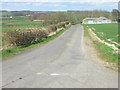
10
Wind turbine and woodland
Near Tuft Hill Farm.
Off Woldgate Roman Road.
Image: © JThomas
Taken: 21 Feb 2015
0.19 miles