IMAGES TAKEN NEAR TO
Sledmere, DRIFFIELD, YO25 3XZ
Introduction
This page details the photographs taken nearby to YO25 3XZ by members of the Geograph project.
The Geograph project started in 2005 with the aim of publishing, organising and preserving representative images for every square kilometre of Great Britain, Ireland and the Isle of Man.

There are currently over 7.5m images from over14,400 individuals and you can help contribute to the project by visiting https://www.geograph.org.uk
Image Map (Loading...)


Getting Data...Please wait
Leaflet Map data © OpenStreetMap
Images are licensed for reuse under creativecommons.org/licenses/by-sa/2.0
Notes
- Clicking on the map will re-center to the selected point.
- The higher the marker number, the further away the image location is from the centre of the postcode.
Image Listing (9 Images Found)
Images are licensed for reuse under creativecommons.org/licenses/by-sa/2.0
Image
Details
Distance
2
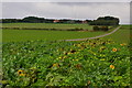
Entrance to Farm
High on the Wold is the aptly named Thirleby Wold Farm
Image: © Martin Dawes
Taken: 12 Jan 2010
0.04 miles
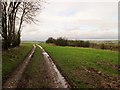
3

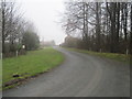
Farm Road down into Croome Dale
This runs up from Croome Road to Thirkleby Wold Farm.
Image: © Martin Dawes
Taken: 12 Jan 2010
0.11 miles
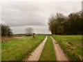
4
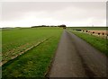
Access road and bridleway to Thirkleby Wold farm
The bridleway passes the farm and goes over the wold toward West Lutton
Image: © Martin Dawes
Taken: 27 Jan 2016
0.14 miles
5
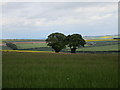
Two trees on Thirkelby Wold
These two trees stand out in the wide expanses of the Wolds landscape.
Image: © Jonathan Thacker
Taken: 22 May 2015
0.20 miles
6
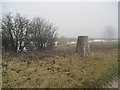
Trig Point and disused Pit
Alongside the bridleway over Thirkleby Wold
Image: © Martin Dawes
Taken: 12 Jan 2010
0.20 miles
7
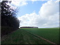
Bridleway over Thirkleby Wold
To the right a large pit (disused) and between the track and the bushes at the left of the pit is a trig point
Image: © Martin Dawes
Taken: 27 Jan 2016
0.21 miles
8
Trig point on Thirkleby Wold
Bridleway and track toward Thirkleby Wold farm which is behind the shelter belt trees to the right.A large pit (disused) is to the left of the trig point
Image: © Martin Dawes
Taken: 27 Jan 2016
0.21 miles