
IMAGES TAKEN NEAR TO
Towthorpe, DRIFFIELD, YO25 3HF
Introduction
This page details the photographs taken nearby to YO25 3HF by members of the Geograph project.
The Geograph project started in 2005 with the aim of publishing, organising and preserving representative images for every square kilometre of Great Britain, Ireland and the Isle of Man.

There are currently over 7.5m images from over14,400 individuals and you can help contribute to the project by visiting https://www.geograph.org.uk
Image Map
Images are licensed for reuse under creativecommons.org/licenses/by-sa/2.0
Notes
- Clicking on the map will re-center to the selected point.
- The higher the marker number, the further away the image location is from the centre of the postcode.
Image Listing (6 Images Found)
Images are licensed for reuse under creativecommons.org/licenses/by-sa/2.0
Image
Details
Distance

2

Towthorpe Field
Looking from the Fimber, Sledmere road.
Image: © Stephen Horncastle
Taken: 10 Mar 2007
0.15 miles

4
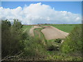
From Earthworks to Towthorpe
From the path along the top of the earthworks along York Bank a steep wooded drop into York Dale. The B1251 Fimber to Sledmere runs in the bottom,a disused pit across the road to the right of the farm track which runs all the way to the trees on the horizon which shield Towthorpe Manor Farm and is also the site of the medieval village of Towthorpe.All land in this photo is private.
Image: © Martin Dawes
Taken: 13 May 2013
0.21 miles
5
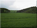
Broad Dale with York Bank to the Right
Behind the hedge to the left is the B1251 road to Sledmere
Image: © Martin Dawes
Taken: 13 May 2010
0.22 miles
6
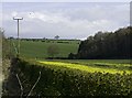
Broad Dale, near Fimber, E Yorks
Farmland/woodland to the east of the B1251
Image: © Paul Harrop
Taken: 1 May 2015
0.23 miles