
IMAGES TAKEN NEAR TO
Wetwang, DRIFFIELD, YO25 3EZ
Introduction
This page details the photographs taken nearby to YO25 3EZ by members of the Geograph project.
The Geograph project started in 2005 with the aim of publishing, organising and preserving representative images for every square kilometre of Great Britain, Ireland and the Isle of Man.

There are currently over 7.5m images from over14,400 individuals and you can help contribute to the project by visiting https://www.geograph.org.uk
Image Map
Images are licensed for reuse under creativecommons.org/licenses/by-sa/2.0
Notes
- Clicking on the map will re-center to the selected point.
- The higher the marker number, the further away the image location is from the centre of the postcode.
Image Listing (17 Images Found)
Images are licensed for reuse under creativecommons.org/licenses/by-sa/2.0
Image
Details
Distance
1

Station Farm, near Wetwang
Built between 1850 and 1890, on the north side of the Malton & Driffield Junction Railway.
Image: © Christine Johnstone
Taken: 20 Apr 2021
0.02 miles

3

Station Farm
The footpath from Wetwang goes past this farm
Image: © Martin Dawes
Taken: 8 Aug 2009
0.03 miles
4

Station Farm near Wetwang
From the access road to Wetwang Grange
Image: © Martin Dawes
Taken: 9 Jun 2020
0.03 miles
5

The former Malton and Driffield Junction Railway
At the entrance to Station Farm, near Wetwang. This part of the railway route is now a farm access road and a public footpath.
Image: © Christine Johnstone
Taken: 20 Apr 2021
0.06 miles
6
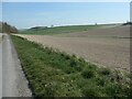
The Grits, Wandale
On the 1850 large-scale OS map, 'The grits' is the name given to this land alongside the former railway line.
Image: © Christine Johnstone
Taken: 20 Apr 2021
0.08 miles
7

Private access track, south of Station Farm
In about 200 metres it bends slightly to make use of the route of the former Malton and Driffield Junction Railway.
Image: © Christine Johnstone
Taken: 20 Apr 2021
0.11 miles
8

Low Bitings, North Field, looking west
The names come from the large-scale OS map surveyed in 1850. The trees are a shelter belt on the north side of Station Farm.
Image: © Christine Johnstone
Taken: 20 Apr 2021
0.13 miles

