IMAGES TAKEN NEAR TO
Herdsman Road, YORK, YO24 2UL
Introduction
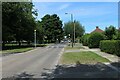
This page details the photographs taken nearby to Herdsman Road, YO24 2UL by members of the Geograph project.
The Geograph project started in 2005 with the aim of publishing, organising and preserving representative images for every square kilometre of Great Britain, Ireland and the Isle of Man.

There are currently over 7.5m images from over14,400 individuals and you can help contribute to the project by visiting https://www.geograph.org.uk
Image Map (Loading...)


Getting Data...Please wait
Leaflet Map data © OpenStreetMap
Images are licensed for reuse under creativecommons.org/licenses/by-sa/2.0
Notes
- Clicking on the map will re-center to the selected point.
- The higher the marker number, the further away the image location is from the centre of the postcode.
Image Listing (43 Images Found)
Images are licensed for reuse under creativecommons.org/licenses/by-sa/2.0
Image
Details
Distance
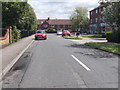
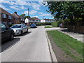
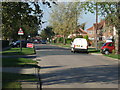
5
Chaloners Road, York
Residential area in the Dringhouses district of York
Image: © Chris Heaton
Taken: 9 Jul 2022
0.04 miles
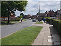
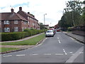
10
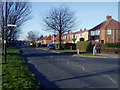
Chaloners Road, York
This grid square is almost empty on the 1940s map, but has now been filled with late-20th Century housing developments.
Image: © John Armitstead
Taken: 18 Feb 2006
0.08 miles